
Finding Columbia Heights
In 1893, a San Francisco neighborhood was born in the countryside. It took just a few decades to shoo away the cows and get piped-in water.


In 1893, Easton, Eldridge & Co. announced the opening of a keystone-shaped residential development along the west side of San Jose Avenue south of Ocean Avenue. “Columbia Heights” was wedged between existing homestead maps on the edge of a ridgeline today known as Merced Heights.
Let me orient you, modern reader. If you’re driving south down Interstate 280, Columbia Heights is the promontory on your right just after you pass City College and the series of three freeway overpasses for Ocean, Geneva, and San Jose Avenues. If you walk out of the Balboa Park BART station it’s just to the southwest across the freeway. If you’re attending Lick-Wilmerding High School, it’s that hill right behind you kid.
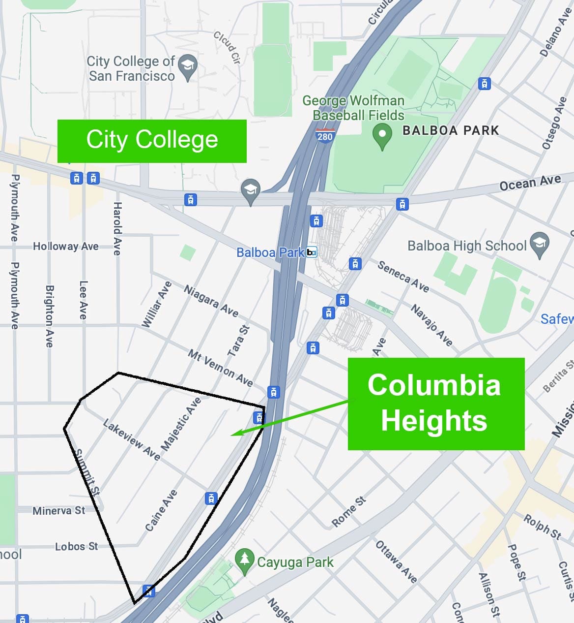
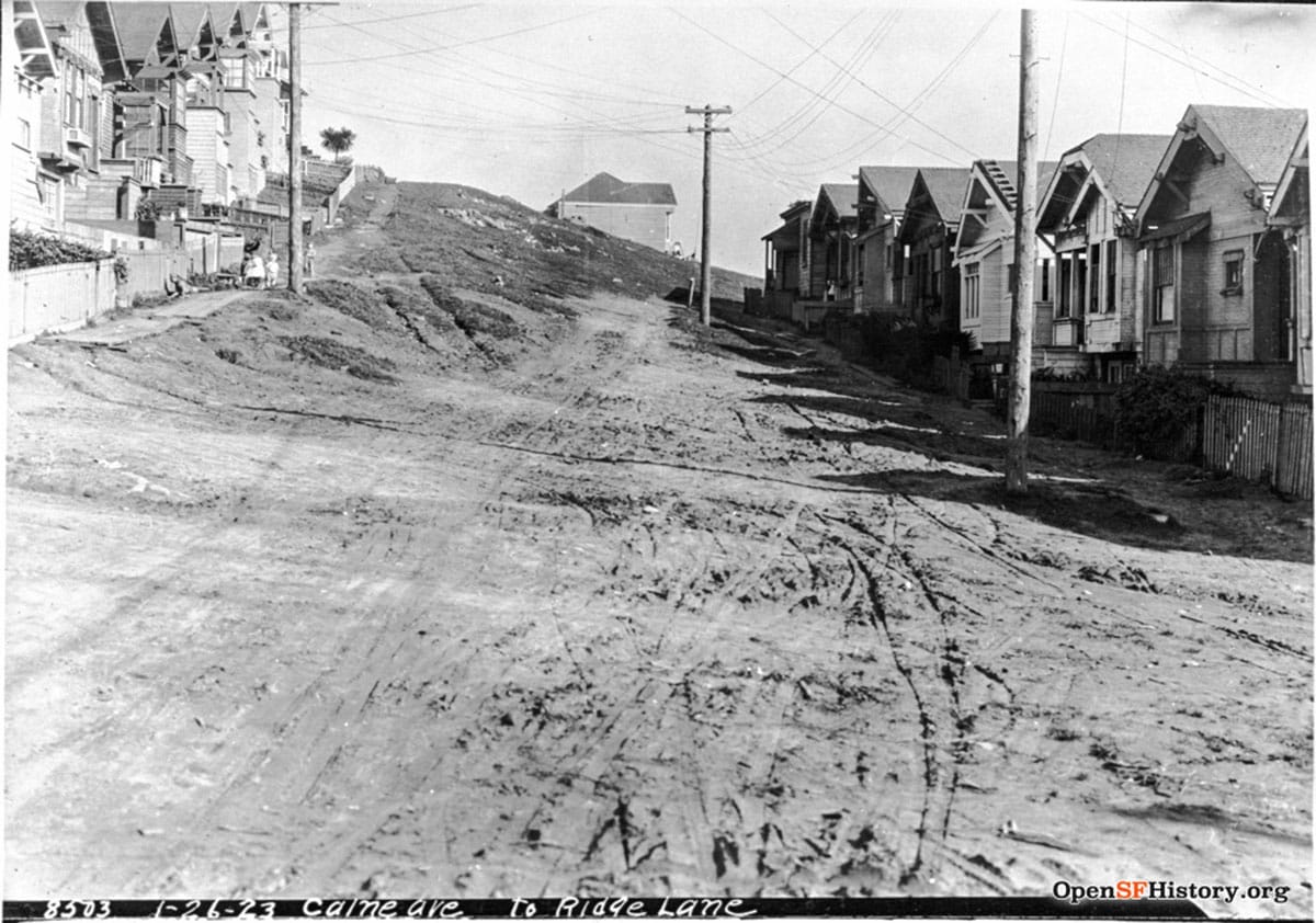
In the 19th century this was terra incognita to most San Franciscans, and frankly, still is today. The names of the border streets—Summit Avenue and Ridge Lane—give some sense of its elevated view over a valley both bucolic and industrial.
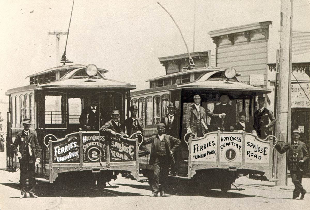
Truck farms, duck ranches, and hog corrals covered the land below. Islais Creek wound north and east through fields to the bay. Amongst water-pumping windmills were tanneries, laundries, and steam-train tracks snaking to the peninsula. And a new transportation link—the city’s first electric streetcar line—had just been laid along San Jose Avenue, an enterprise which likely spurred the creation of Columbia Heights.
What would tempt a buyer to take a chance on a 25 x 100-foot lot mapped on a rocky, unimproved hillside miles away from the jobs of downtown? After all, there were more than enough available lots in surrounding Ocean View, Ingleside, and closer to the city core.
For one, Easton Eldridge & Co. pitched the “elegant home lots” as having “perfect natural drainage and perpetual sunshine.” (Except for all the fog, one might here cough and mutter.) And Columbia Heights was cheap: lots at the auction went for as little as $145 ($5,000 in 2024 dollars).
While Columbia Heights’ sellers heralded the tract as the opportunity in a lifetime for the artisan, clerk, mechanic, and laborer, their primary buyers were likely speculators.
Then, as now, people with money liked to park it in San Francisco real estate with the expectation to cash in at a late date or, if excitement over the new streetcar line created a rush of investors, even sooner.
Easton, Eldridge & Co. predicted “No doubt 200 per cent profit can be made within a year on the investment.”
(Let me kill the suspense here: big nope on that 12-month 200% profit.)
Columbia Heights remained little more than a name and a map for more than a decade. Of the 391 lots in the tract only 68 sold in the 1893 auction. A few cottages were constructed on the hill and despite the promises, it was not a land of perpetual sunshine or perfect weather. A big storm on January 5, 1895 blew one of the first houses over: “…boards were carried away by the winds. Household furniture was scattered in all directions.”
There was no gas or electricity. The street grades weren’t established. There were no sewers. You had to dig your own well. Real estate ads assured potential buyers that “pure water can be had by boring 14 feet.”
The Sanborn Fire Insurance Company didn’t bother to survey the mostly empty neighborhood in 1905. But the next year, when the April 18, 1906 earthquake and subsequent fires eradicated the homes of more than 250,000 San Franciscans, Columbia Heights suddenly got sexy.
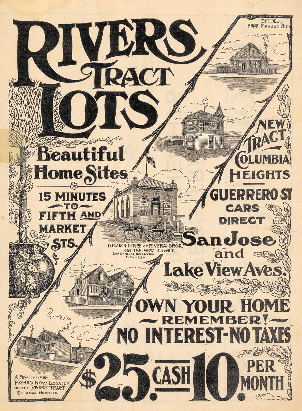
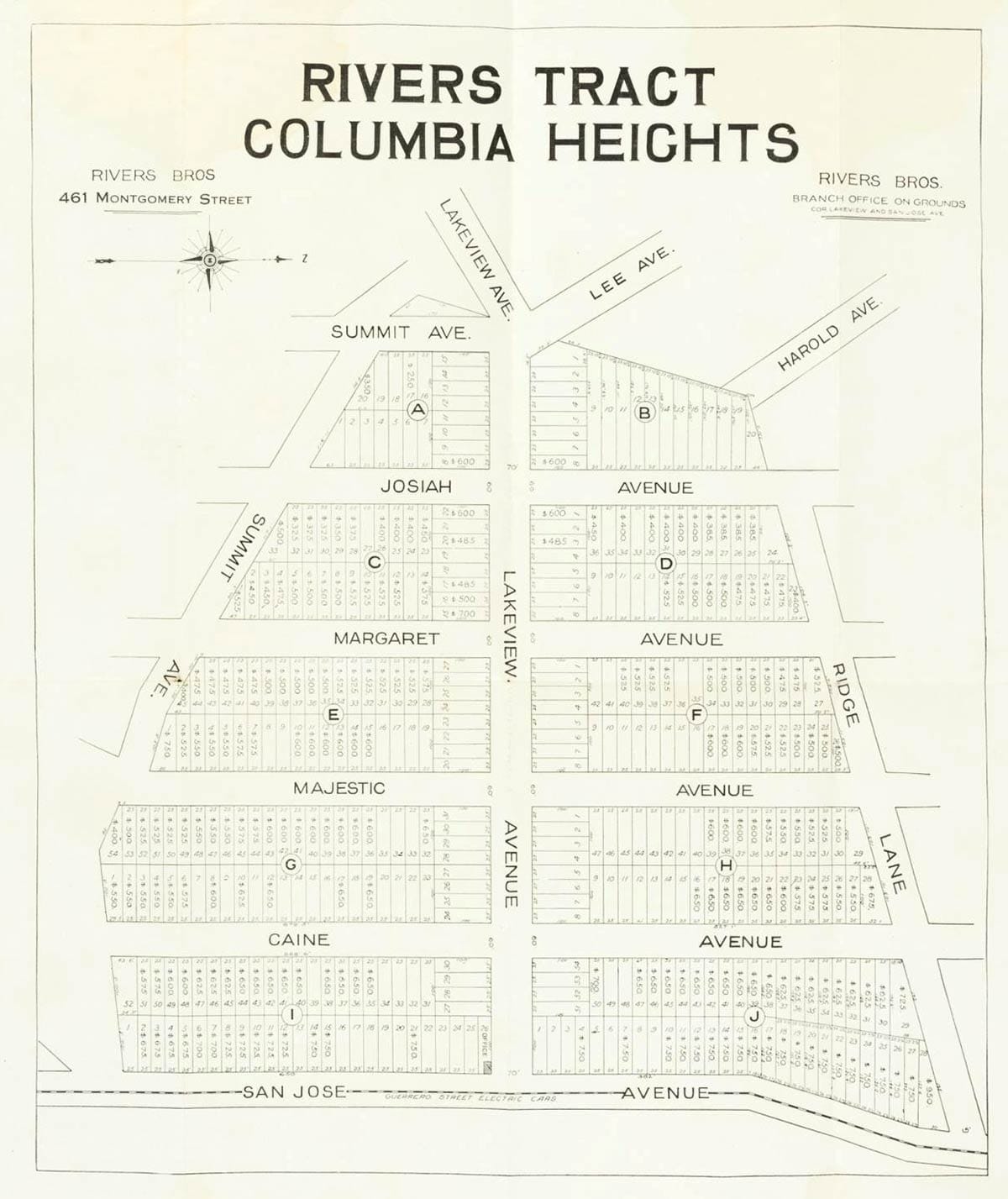
In 1907, during the post-quake land rush west and south of the fire zone, brothers Thomas and Christopher Rivers acquired the unsold property of the tract. By the time the Rivers brothers had built a few speculative houses and began advertising, 108 of the 391 lots in Columbia Heights had structures on them.
Again, the lofty rocky outcrop was described fulsomely: “A perfect view of Ocean, Bay and foothills is obtainable at Columbia Heights. There is sunshine and fresh air in abundance. The soil is a rich alluvial loam in which anything for the garden can be raised, making it an ideal home place. Perfect drainage is made possible by the slope of the land.”
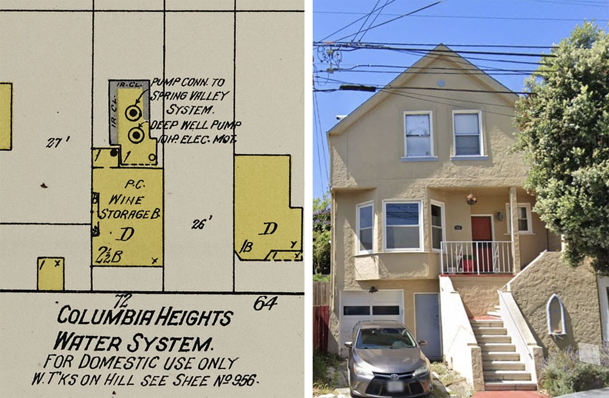
Perfect natural drainage it may have had, but not infrastructure. The private Spring Valley Water Company that controlled the city’s water supply didn’t feel the customer base on the ridge was worth laying new water mains.
For a number of years an enterprising resident named George Wilson created his own utility company by tapping a spring on his Majestic Avenue property and piping water to his neighbors for a fee. Under city pressure, Spring Valley finally bought him out and the DIY water works was included on the 1915 Sanborn map:
Another drawback of living in Columbia Heights? The neighbors’ pesky cows. On July 9, 1907, the Rivers Brothers complained to the city’s board of supervisors that livestock habitually trespassed on their property. The supervisors referred the matter to its health committee.
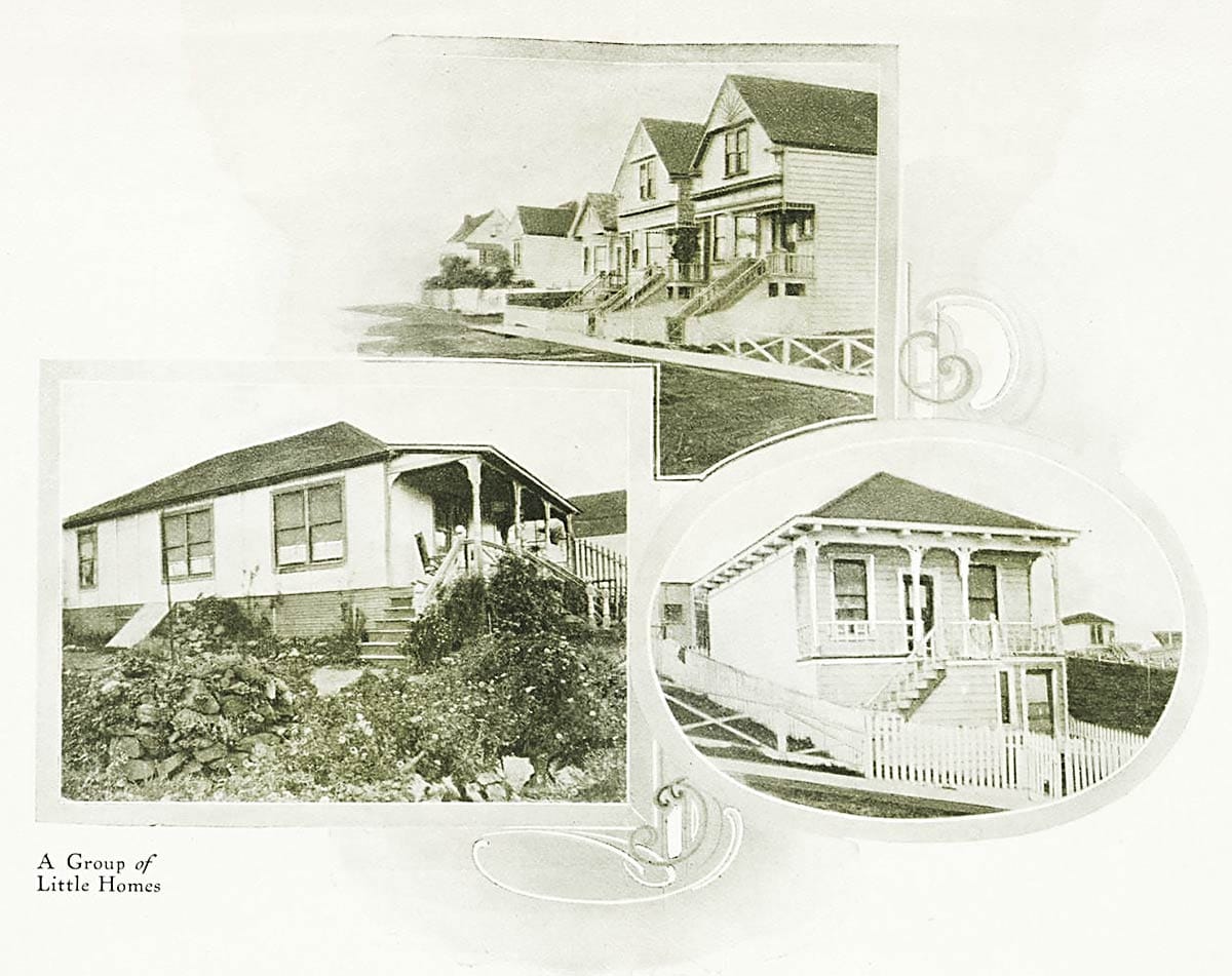
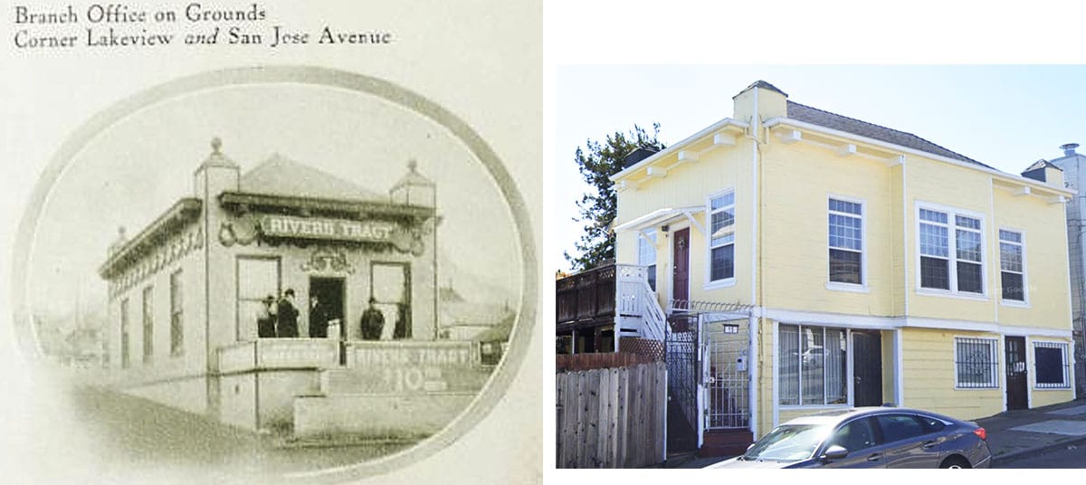
Rivers Brothers’ sales brochures and broadsheets showed off the best buildings, even if the best in the area were pretty humble. The less-than-perfect weather and more than a century of home improvement projects have been rough on some still standing, but others look pretty good today, including the original sales office.
Despite the initial post-quake rush and the PR campaign, more than 60% of Columbia Heights lots remained open land in 1915. It would take new building booms in the 1920s and 1930s to fill in the wedge.
As I do my own surveying—a historic review of a puzzle piece of streets generally unknown and mostly bypassed—a question arises: Does anyone living today in one of the almost 400 houses of the neighborhood know or use the name Columbia Heights?
Woody Beer and Coffee Fund

Hurray for a new year and thanks to recent contributors to the Woody beverage fund, Ben P., David M. (F.O.W.), and Kerri Y! Let me know when you’re free and let’s find a cool place to meet. I haven’t been everywhere.
Sources
Advertisement, “Homes for All,” Easton, Eldridge & Co., San Francisco Chronicle, April 16, 1893, pg. 4.
“House and Lot,” San Francisco Chronicle, April 19, 1893, pg. 7.
“Tents Sailed in the Air,” San Francisco Chronicle, January 6, 1895, pg. 24.
“Ready to Report in Favor of Franchises,” San Francisco Call, July 9, 1907, pg. 10.
Rivers’ Tract Columbia Heights, sales brochure, circa 1908.