
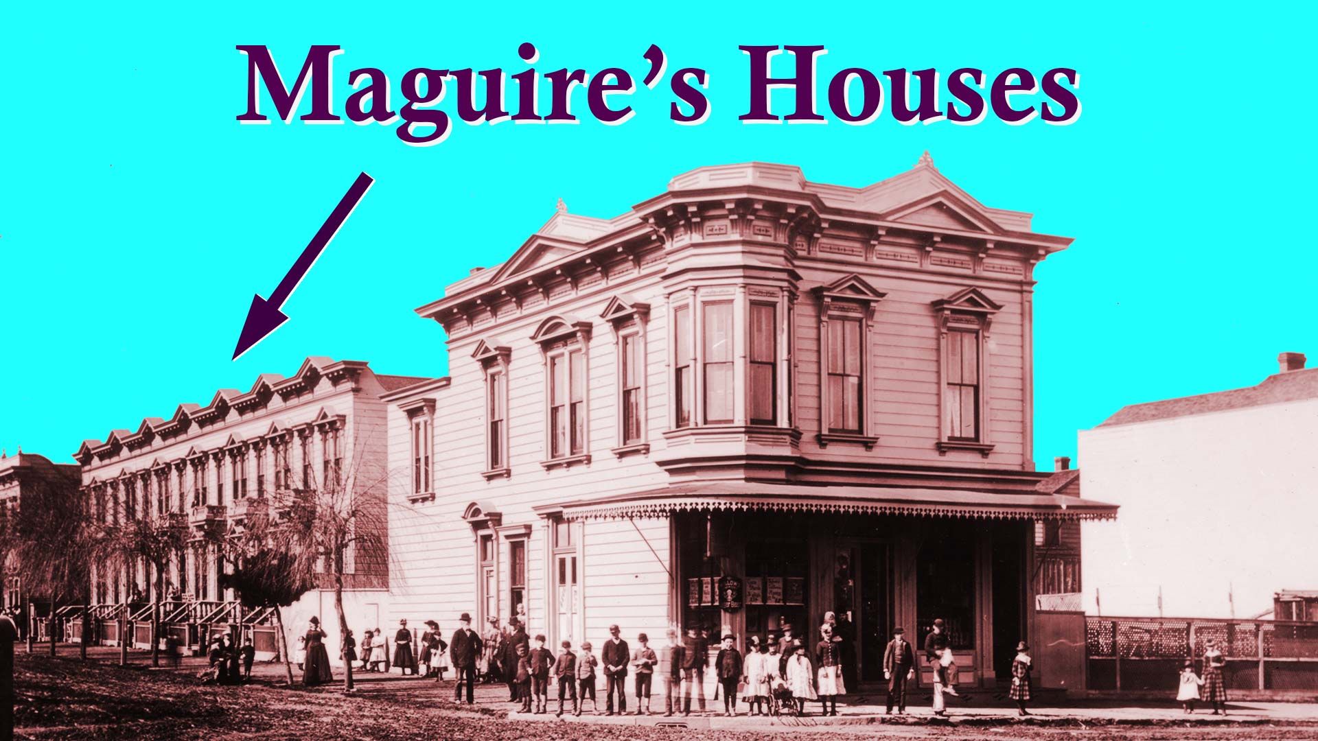
Maguire's Houses
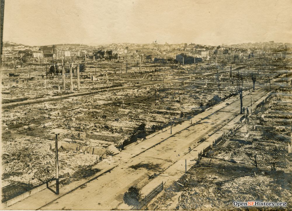
Life on one Mission District block on February 22, 1887 at 11:35 a.m.

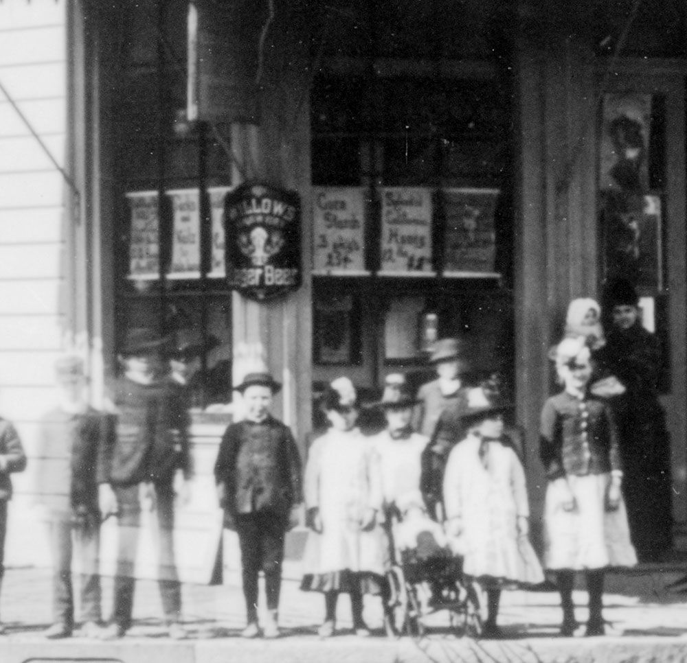
In 2018, while working on the OpenSFHistory project, specifically processing photographs from the Golden Gate National Recreation Area’s Martin Behrman Collection, I was struck by two Mission District images with very descriptive captions. Check out the notations scrawled on the bottom:
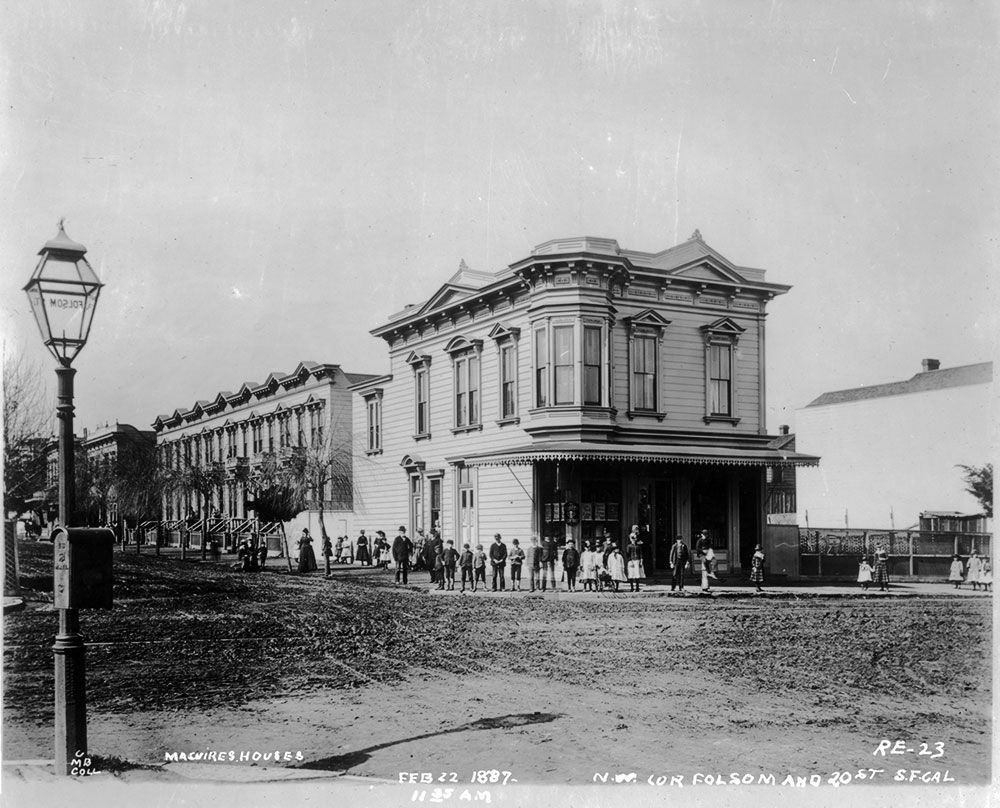
We analyzers of old photos spend a lot of time trying to pin down dates. Based on clothing fashions or automobile models we might guess 1880s or circa 1955 and have little expectation to ever do better. Rarely is the investigator lucky enough to be provided with an exact date, much less the time of day: 11:35 a.m.! Here is the far side of the same block on the same day:
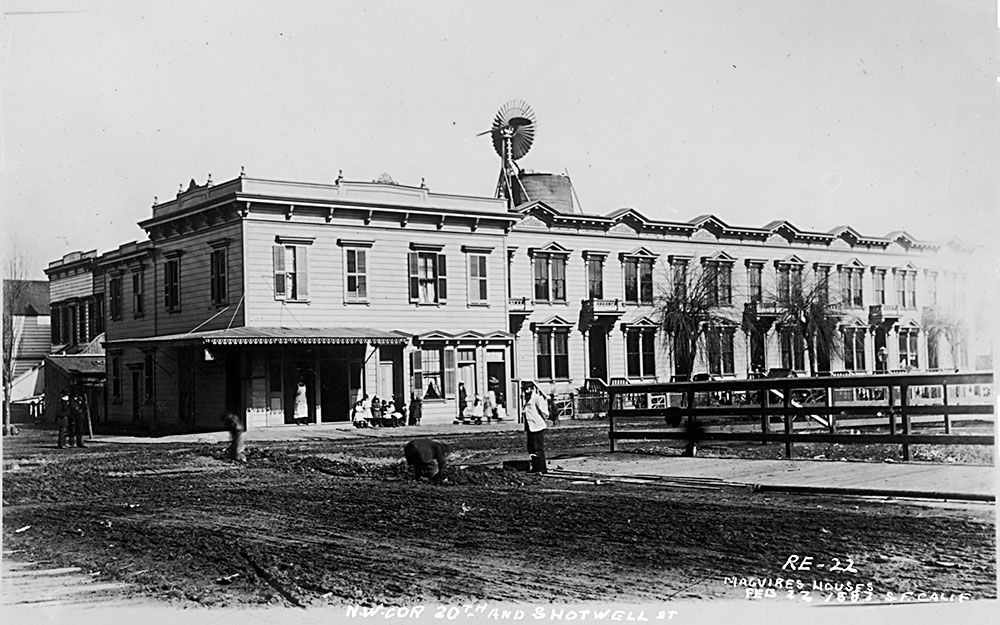
Both photographs document the northern block face of 20th Street between Shotwell and Folsom Streets. The notations make special mention of the residential flats— “Maguire’s houses”—contained in the long mid-block building with the undulating roof line.
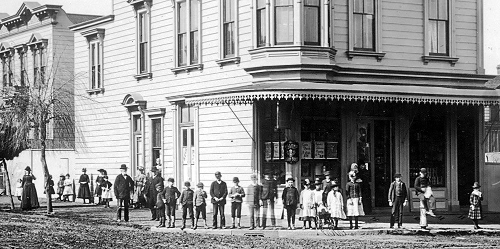
What a great slice of San Francisco time and place. The block has a grocer occupying one corner and a butcher the other. Neighborhood children give their best poses for the photographer. A line of skeletal street trees is visible. In the first photo there’s a mailbox on a lamppost.
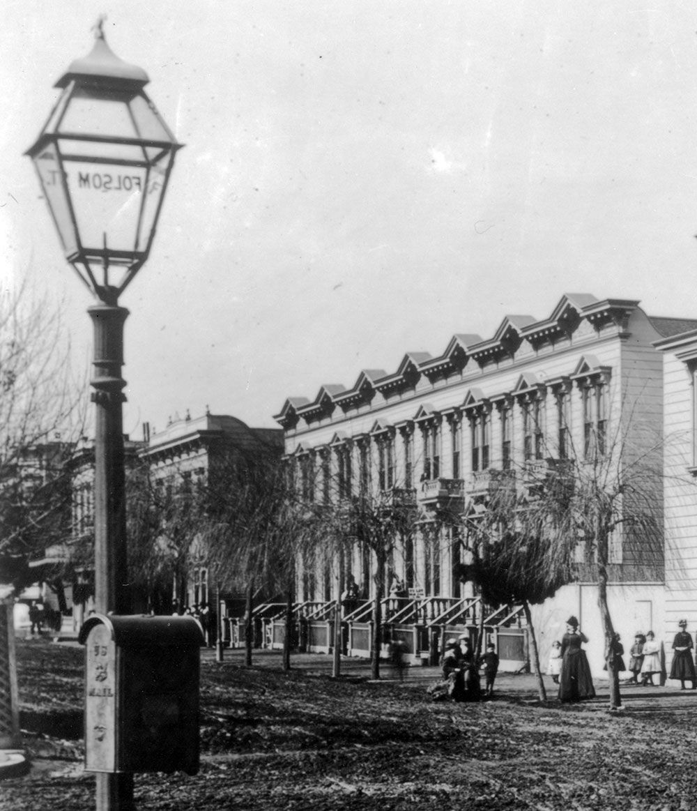
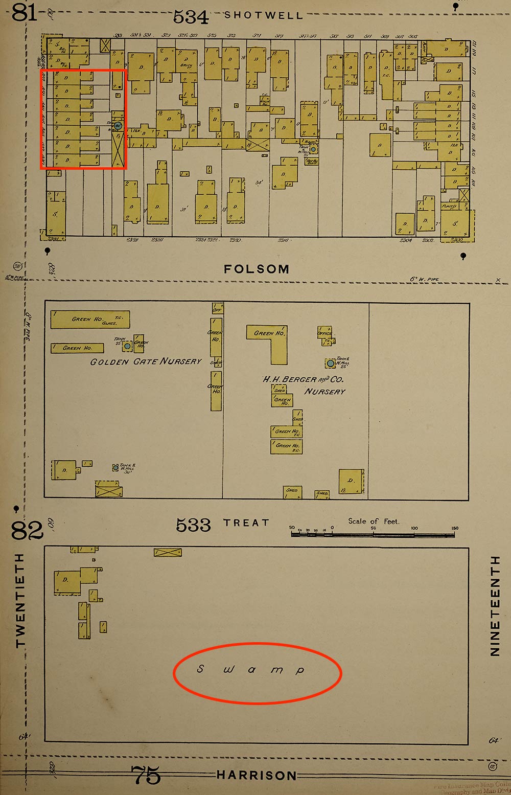
The scene projects a refined urban neighborhood, but the water tower windmill visible in the background of the second photograph gives a clue that infrastructure of city life was relatively recent to the area. About the time these images were taken the block east was mostly open land with greenhouses. A large portion of the block east of that—between Treat Avenue and Harrison Street—was described on the Sanborn fire insurance map as “Swamp.”
The Maguire mentioned in the photo notations was Thomas G. Maguire, a native of Ireland who owned the entire south third of the block. He lived in the corner building on Folsom Street above the ground floor grocery store/bar run by Henry Mangels and later by Charles G. Friedrich. The other corner business, at 20th and Shotwell, was rented to butcher Philip Faubel.
Maguire’s sons, Augustus Benedict Maguire and Joseph Maguire, lived off and on in different residences on the block while running a dry goods business on Mission Street and dealing in real estate and insurance. Thomas was a former plasterer for the Southern Pacific Railroad, but the rents must have been good, because by the time of these photographs he was describing his profession in the city directory as “capitalist.”
Much of the Mission District burned in the fires following the April 18, 1906 earthquake and it was a close call for Maguire’s property. A fire at 22nd and Mission was contained after much effort on the day of the earthquake, and early on April 20, 1906, the great conflagration bearing down from Hayes Valley was stopped just a couple of blocks to the west.
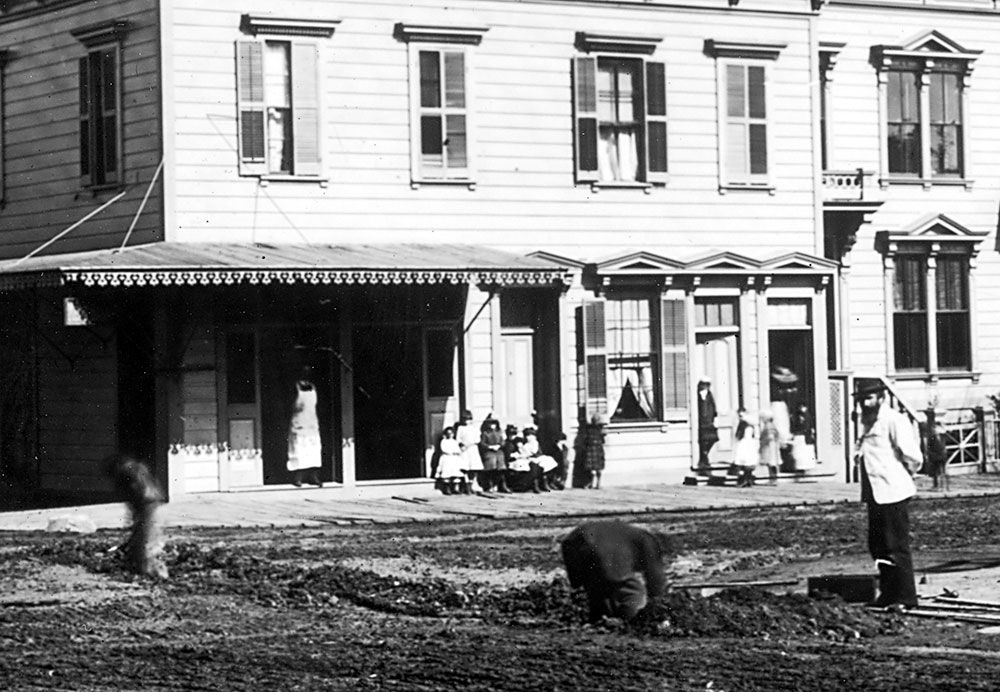
Into the 1910s, Maguire’s row of flats still lined the north side of the street and the old water tower remained a landmark behind them. The meat market became a saloon after the earthquake, but the Folsom Street corner still had the grocery store. During World War I, industrial and commercial warehouses began filling the area, serviced by nearby railroad lines.
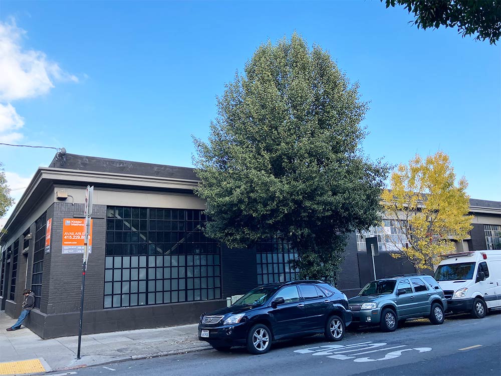
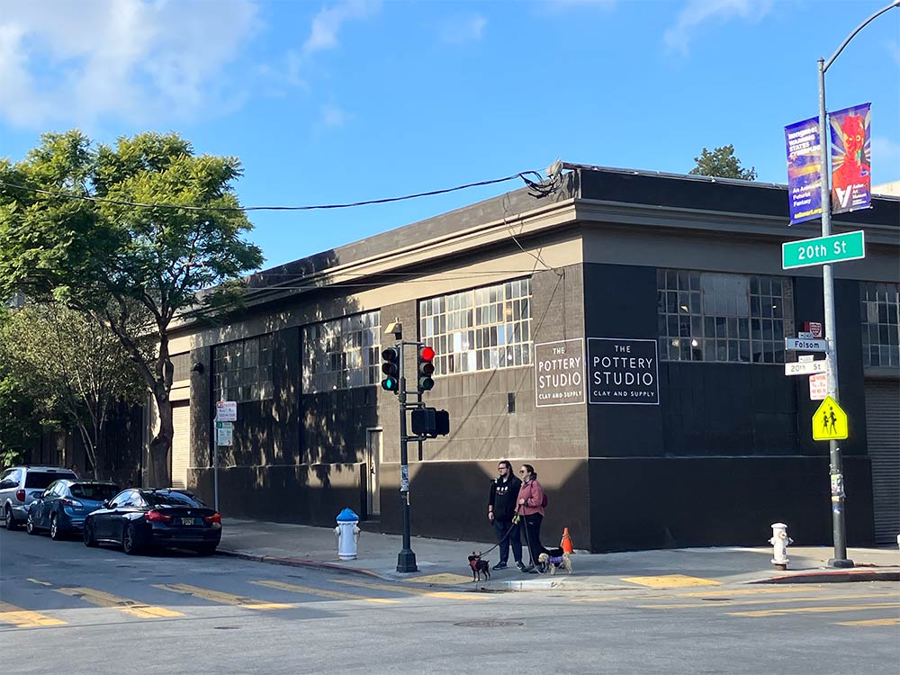
In 1920, the Maguire properties finally succumbed to the changing character of the neighborhood. A 20,000-square-foot brick warehouse for a carpet cleaning company replaced the old grocery, butcher shop, and flats. This warehouse still stands, much older now than the flats were at the time of their demolition. Until recently, it served as a factory for the Timbuk2 messenger bag company. Now, part of it is occupied by a pottery studio with the rest available for lease.
Woody Beer and Coffee Fund Established