
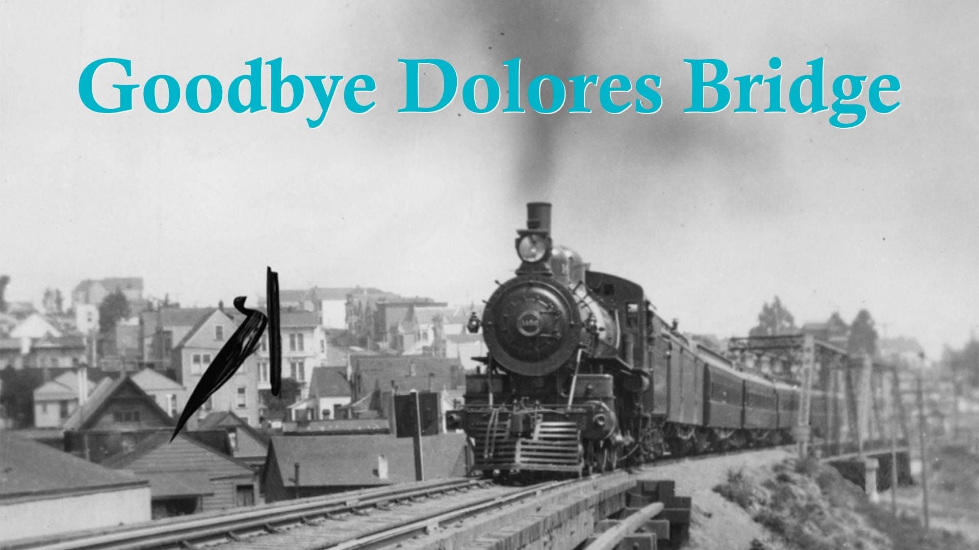
Goodbye Dolores Bridge
When trains passed second-story windows in San Francisco's Noe Valley.

When I started this fun side project, I told people that each San Francisco Story would likely be no more than 500 words and a couple of images. But my enthusiasm gets the better of me and now you are subjected to 1,200-, 1,500-, even (gasp) 2,000-word Wednesday mornings.
Let me know if my prolixity is getting to you. I can try to rein it in, knowing you likely have too much going on and what everyone might want from a local history email is little more than “Cool fact and photo, bro.”
Here’s the fact: There used to be steam trains—like ‘choo-choo!’ from an old movie—running through the Mission District, Noe Valley, and south roughly along the path of Interstate 280. Crazy, huh?
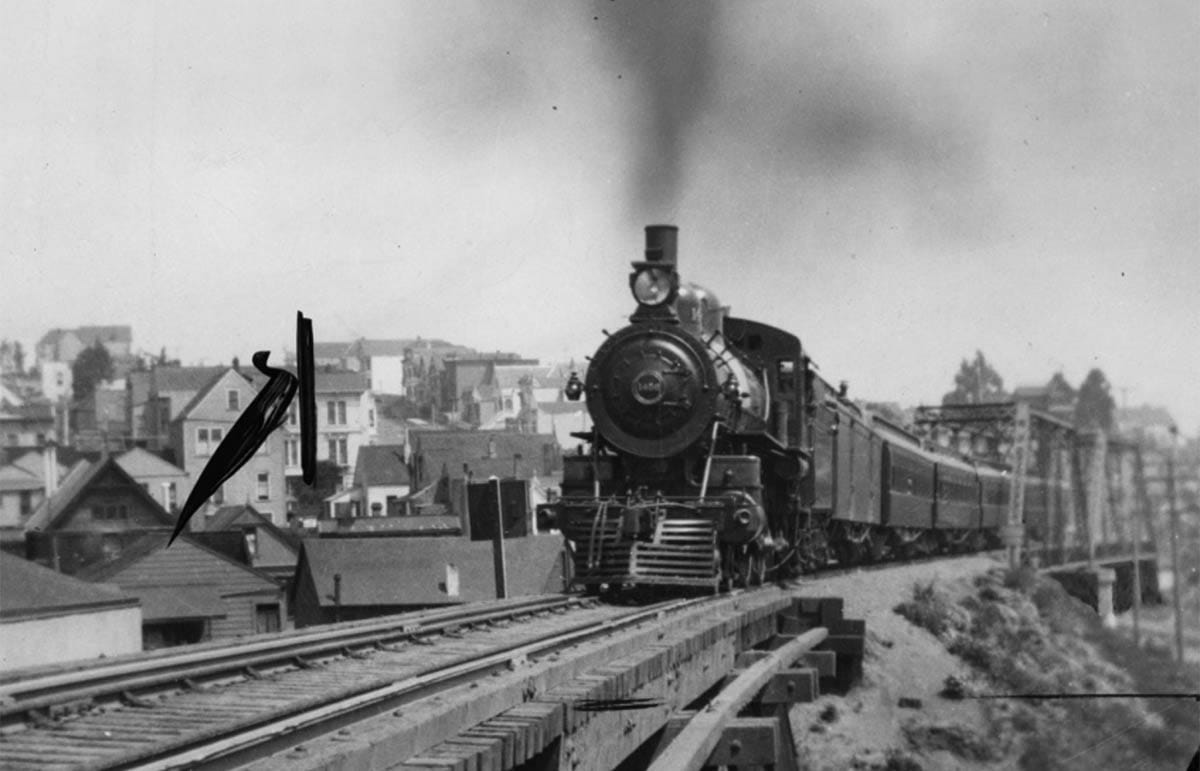
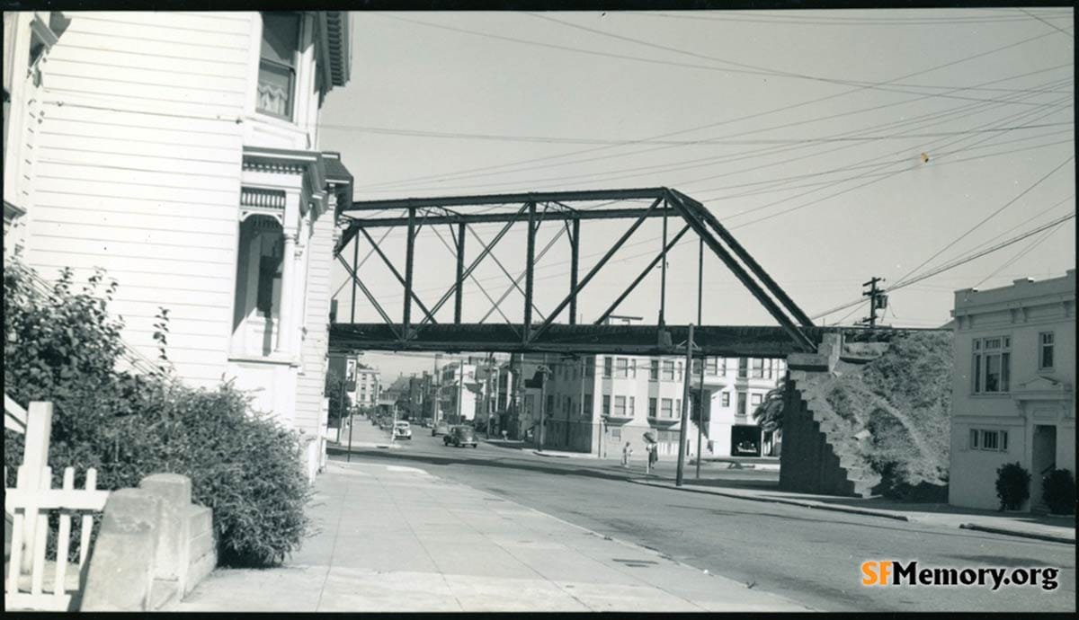
Here’s the photo of one of those trains crossing a railroad bridge over Dolores Street at 27th Street:
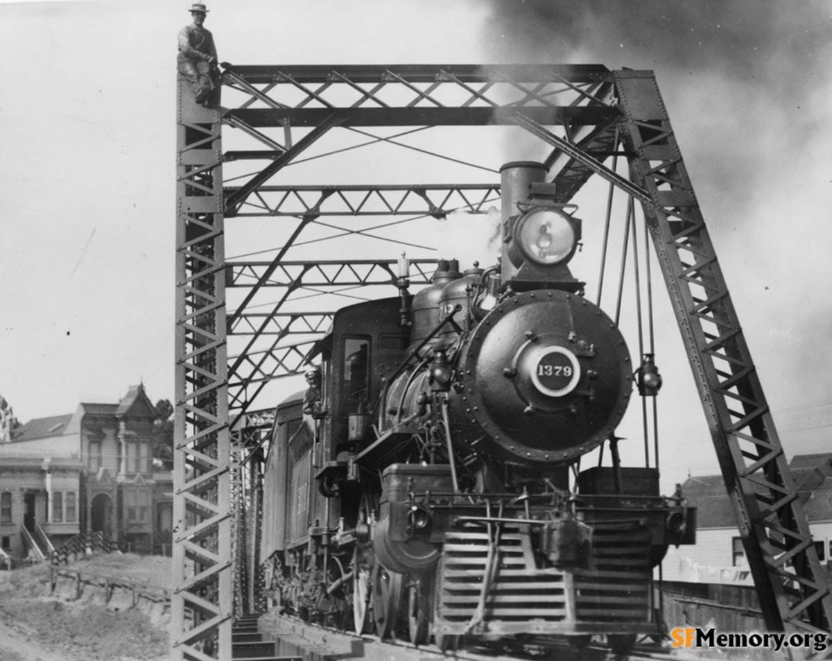
Here is another:
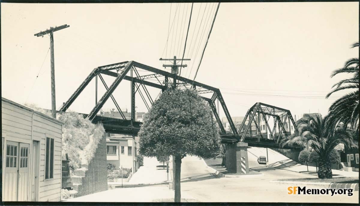
The hulking steel bridge spanned Dolores Street for more than 40 years:
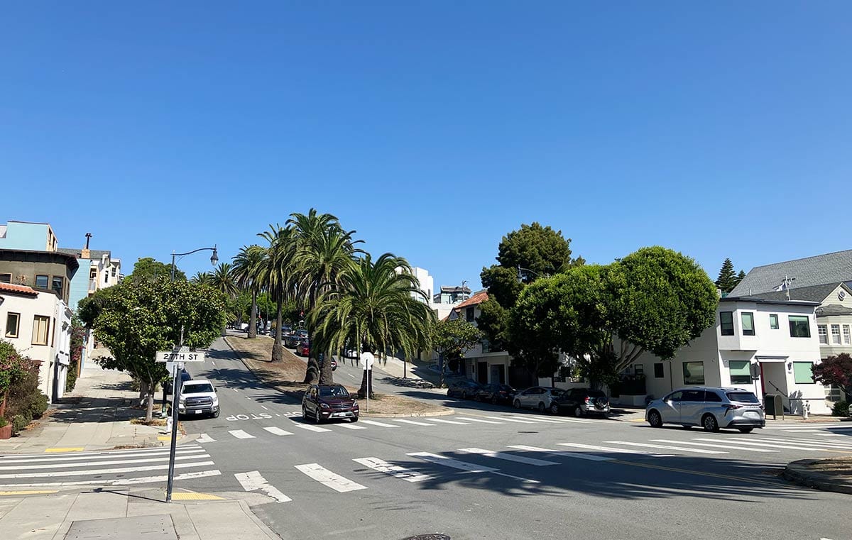
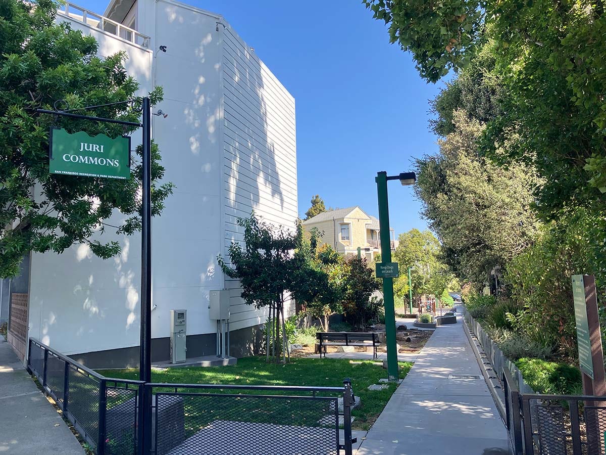
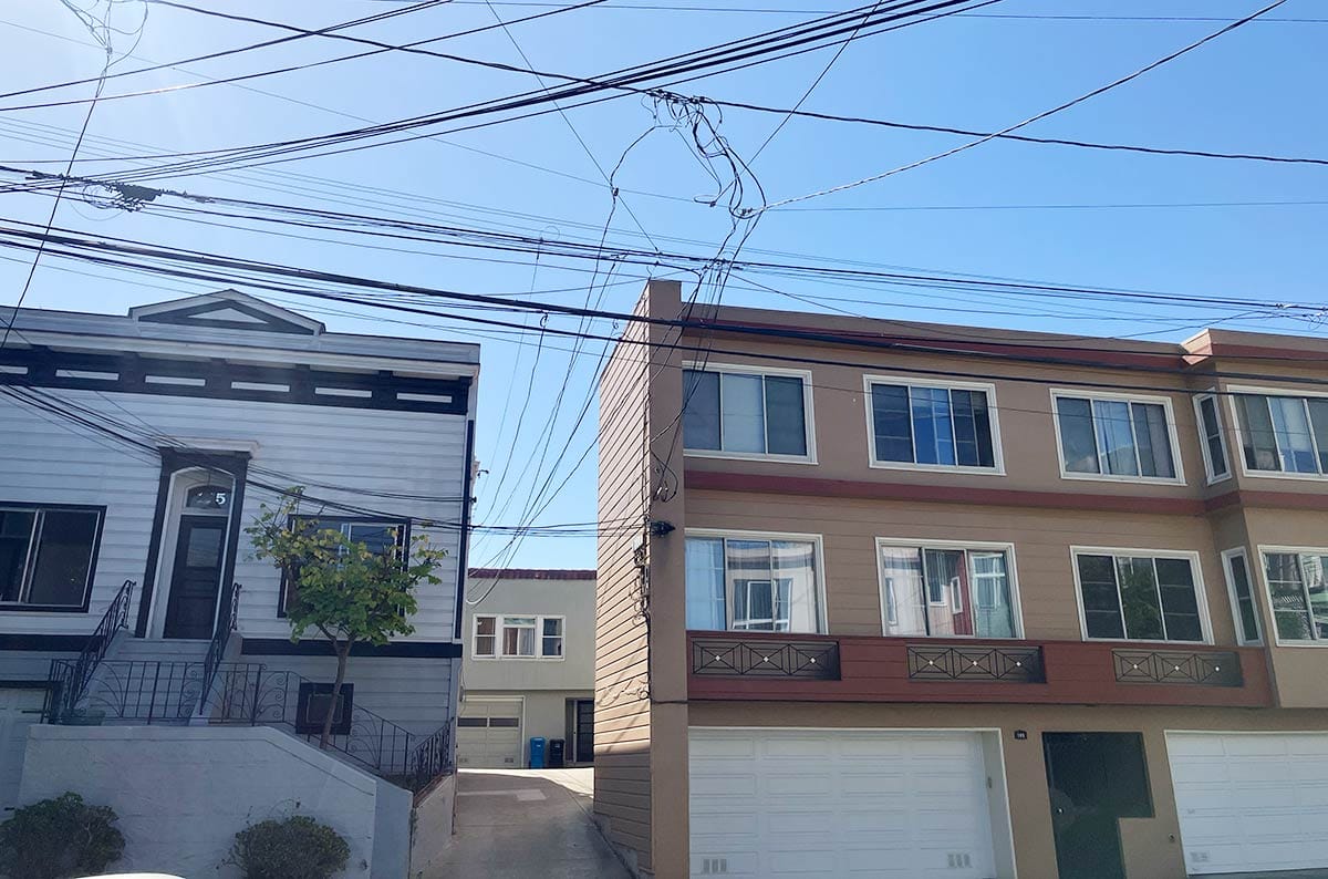
For those who want more than a fact and three photos, we will continue. Here’s the same view today:
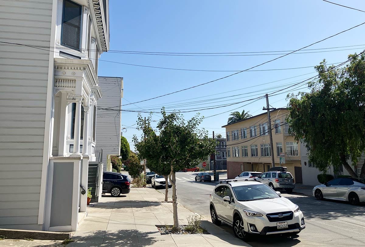
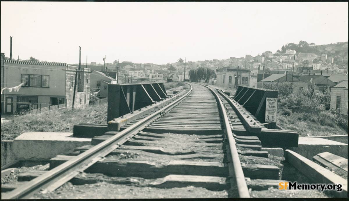
Imagine trying to sleep in the second-story front bedroom of 216 27th Street and having a train rumble past the window:
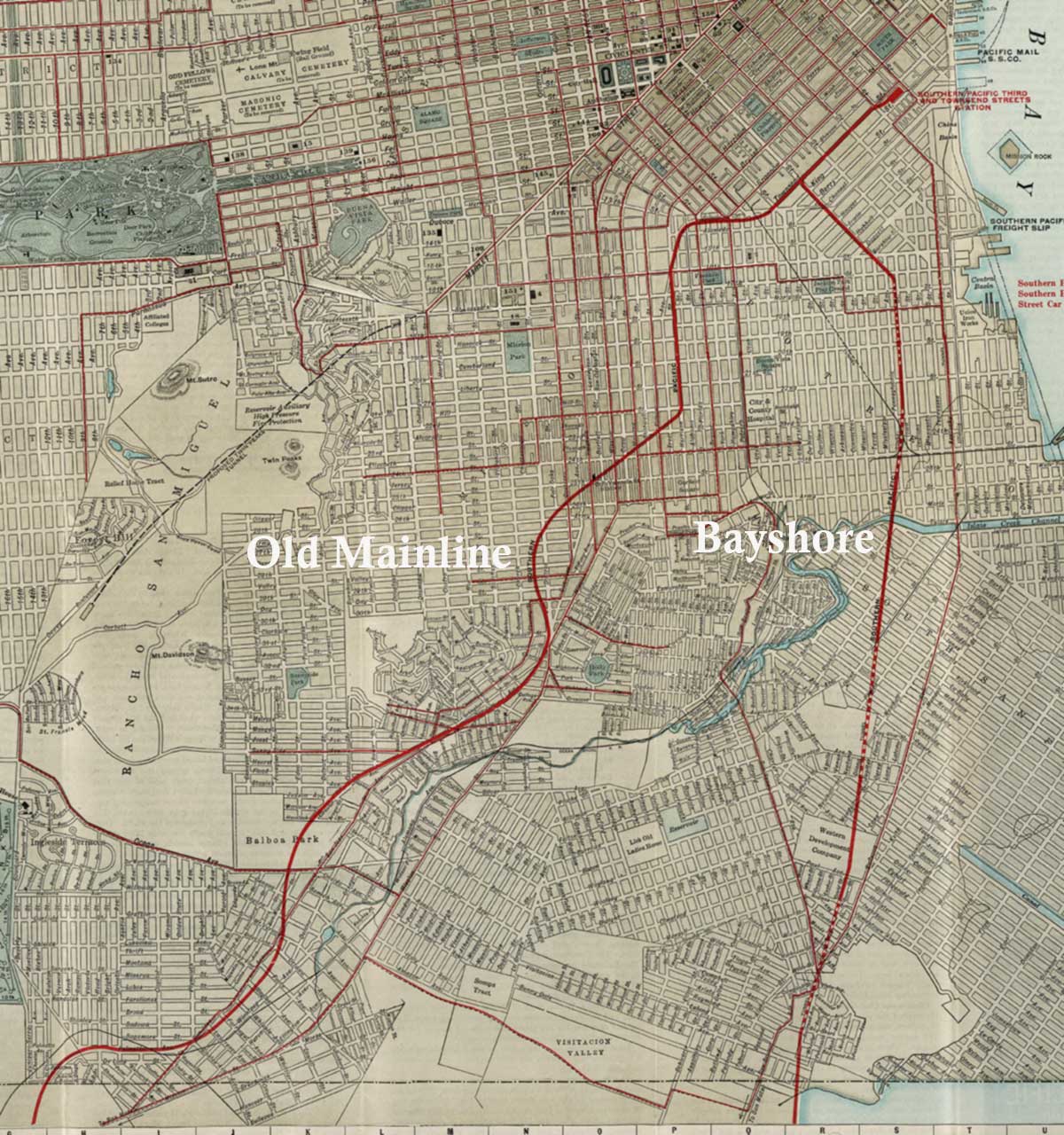
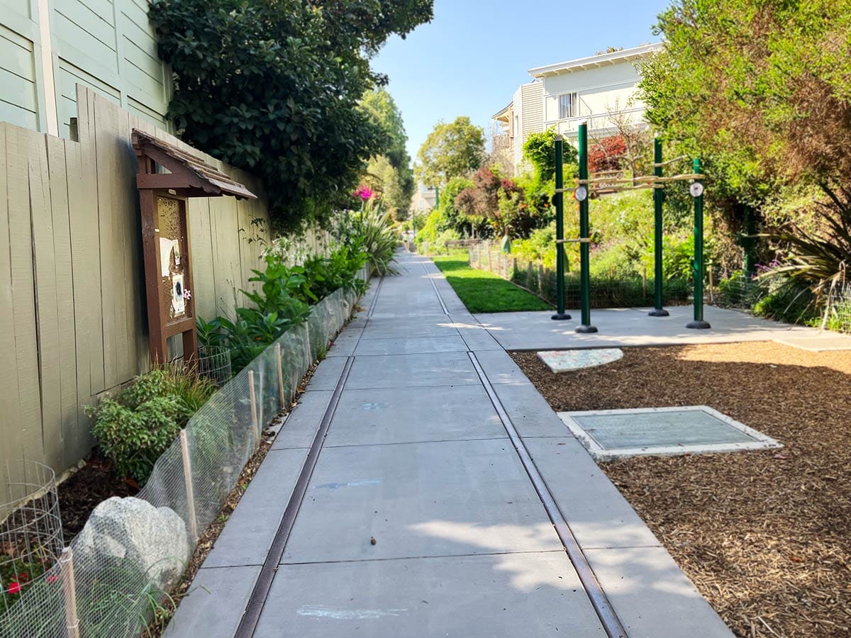
What’s fun is you can walk around today and see evidence of the route of the Southern Pacific's Old Mainline, which was also called the Ocean View line or San Bruno line.
And if you are far from San Francisco (hello to my surprisingly numerous readers abroad), you can trace the path virtually with old photos thanks to David Gallagher’s SFMemory website. If you are really the obsessive type and want to keep heading south, see the excellent annotated slide show created by Stuart Swiedler on the East Bay Hills Project website.
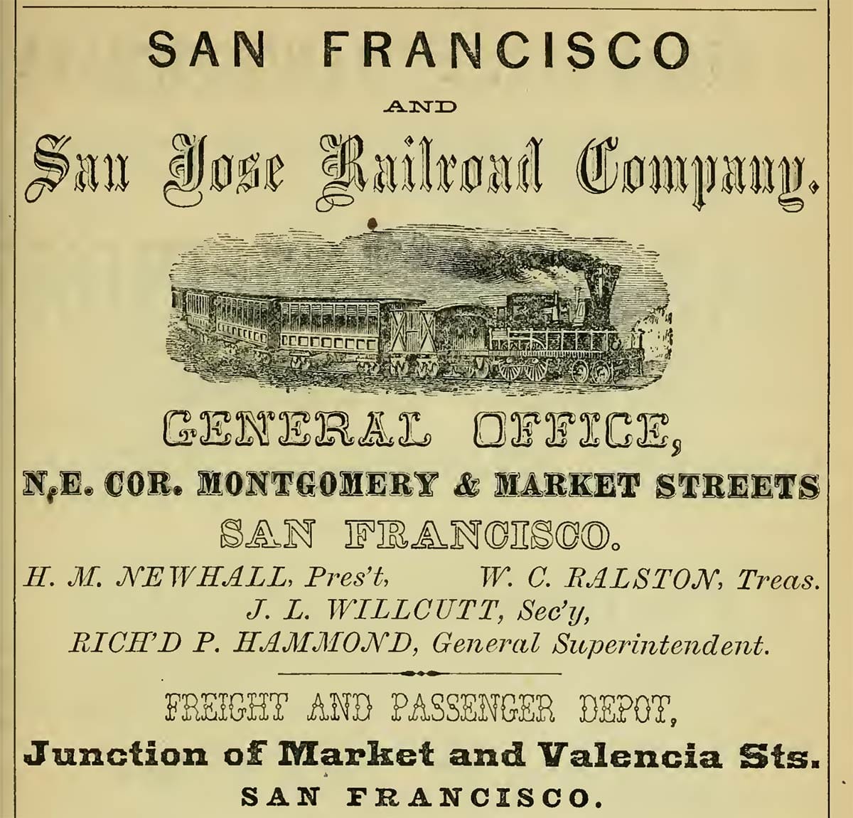
The Mainline dates back to the 1850s as the San Francisco and San Jose Railroad, which was quickly gobbled up by the monopolistic Southern Pacific Company.
The route really got going in the 1860s. Its route out of town skirted the highest hills and was laid down before all the rectilinear blocks and streets of the city map became awkward realities.
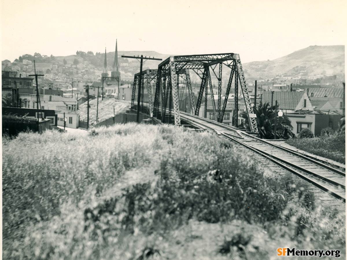
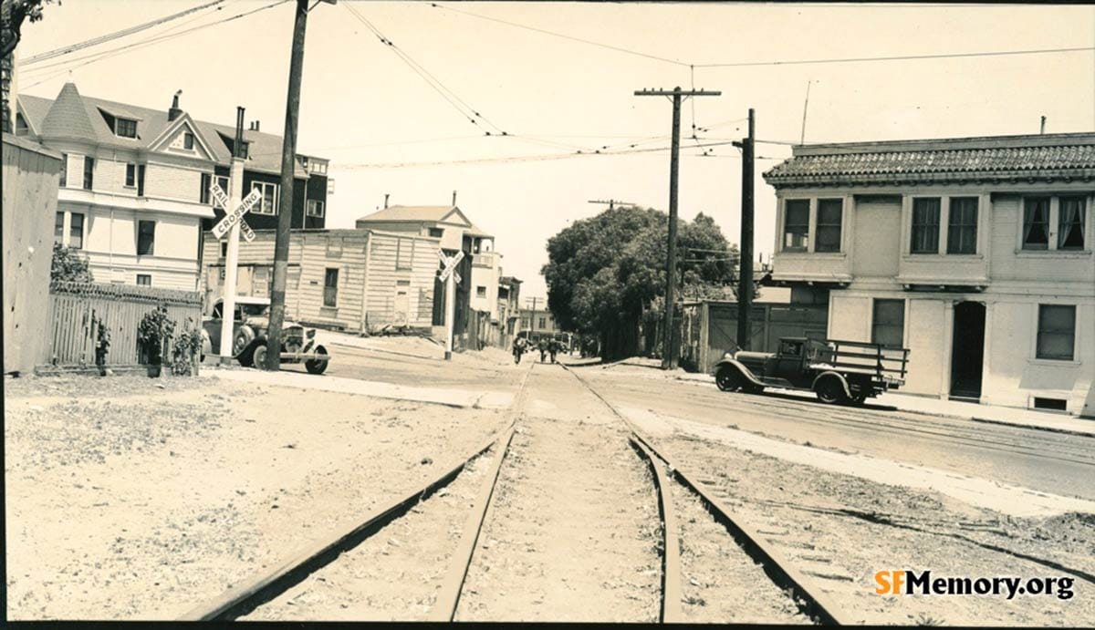
The section through southern Noe Valley needed a serious berm to handle foothills and gullies. The Dolores bridge was constructed in 1890-1891 to help the trains better get through the growing neighborhood and over Dolores Street. Smaller steel trestles spanned 28th, Valley, 29th, Day, and 30th streets.
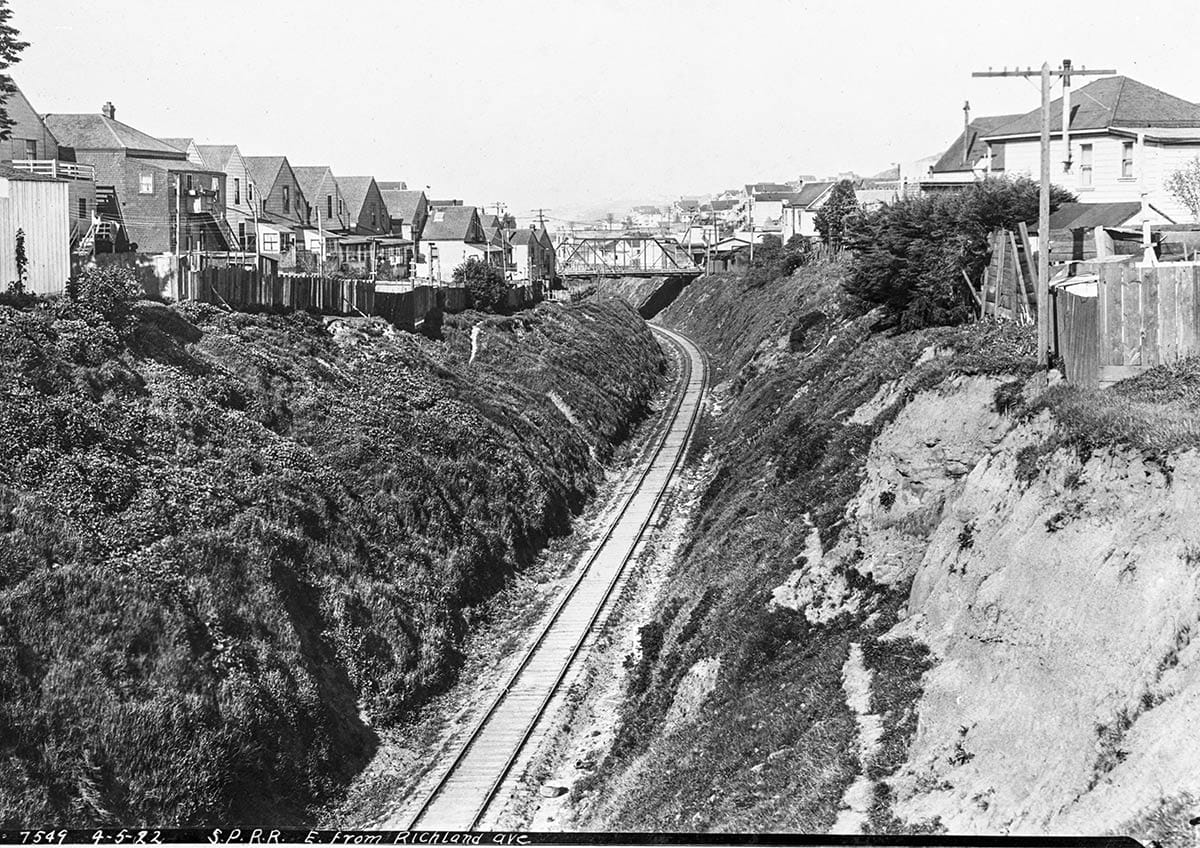
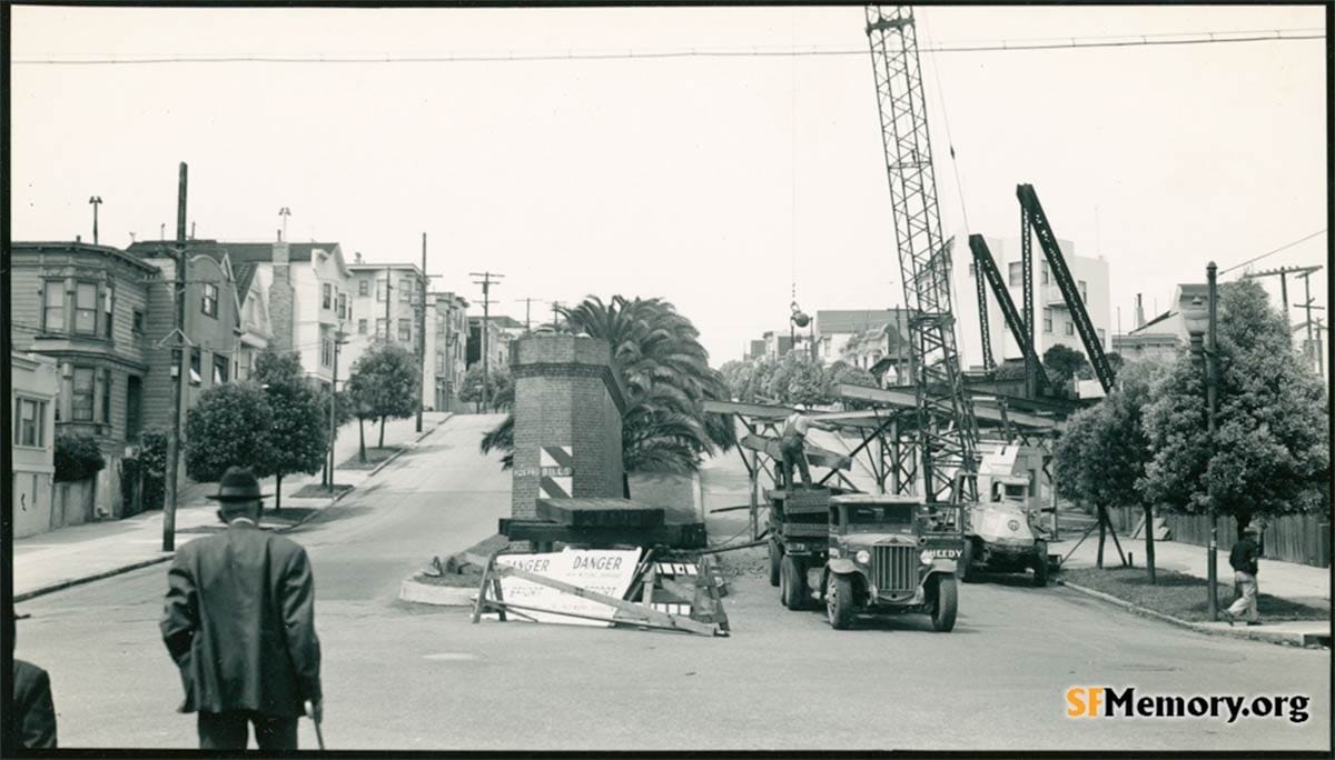
More serious intervention was needed at what is called the Bernal Cut. This is today where Dolores Street and San Jose Avenue feed into an expressway to Glen Park and Interstate 280 and where you are probably driving too fast in your fancy electric automobile.
The original cut was made for the steam trains and much narrower:
A more direct Bayshore rail route required a long bridge across the marshes in front of Visitacion Valley. It was constructed and put in operation in December 1907. After its creation, traffic and service on the Old Mainline declined.
Passenger traffic on the windy western line pretty much ended by the mid 1920s. There was just one early-morning daily train you could catch Mondays through Saturdays in 1928 in which you were likely to ride with a delivery of newspapers and mail and not much else. A 6:50 a.m. departure from San Bruno would supposedly get you to 3rd and Townsend streets by 7:40 a.m.
It was easier to take an electric streetcar or, if you had one, an automobile.
The Mainline continued to move freight through the 1930s. Must have been strange for Mission and Noe Valley locals having a train huffing north on its single track through their back yards.
Southern Pacific officially ended service between Folsom and 23rd Street and the Bernal Cut on August 10, 1942. The state of the rails in photos Robert Mcfarland took in the early 1940s indicate that trains may have stopped running earlier than that.
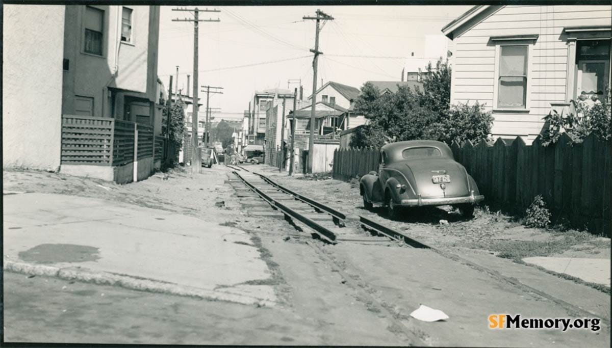
On October 2, 1942, Southern Pacific announced it was taking down the Noe Valley trestles and the Dolores Street bridge as part of a big World War II scrap-metal-collection drive. (Read about some other interesting victims of this campaign.)
Trains continued to occasionally deliver freight to warehouses on the east side of the Mission District into the 1980s. I have a long story of being up too early and not at my best and, well, it is more than a-picture-and-a-fact-story to tell, so we will let that lie.
Woody Beer and Coffee Fund
Ready for that drink with me? People like Robert K. and David F. (F.O.W.) give to the Woody Beer and Coffee Fund just so it can happen! Do not let them down. Tell me when you are free.
Sources
Fred Duerr, “Army Men, Trucks Will Speed Collections,” San Francisco Chronicle, October 2, 1942, pg. 1.
Go to David Gallagher's SFMemory website to Track the Old Mainline
A great visual slide show of the Southern Pacific route had been created by by Stuart Swiedler on the East Bay Hills Project website. (Don't let the East Bay name throw you off...)