
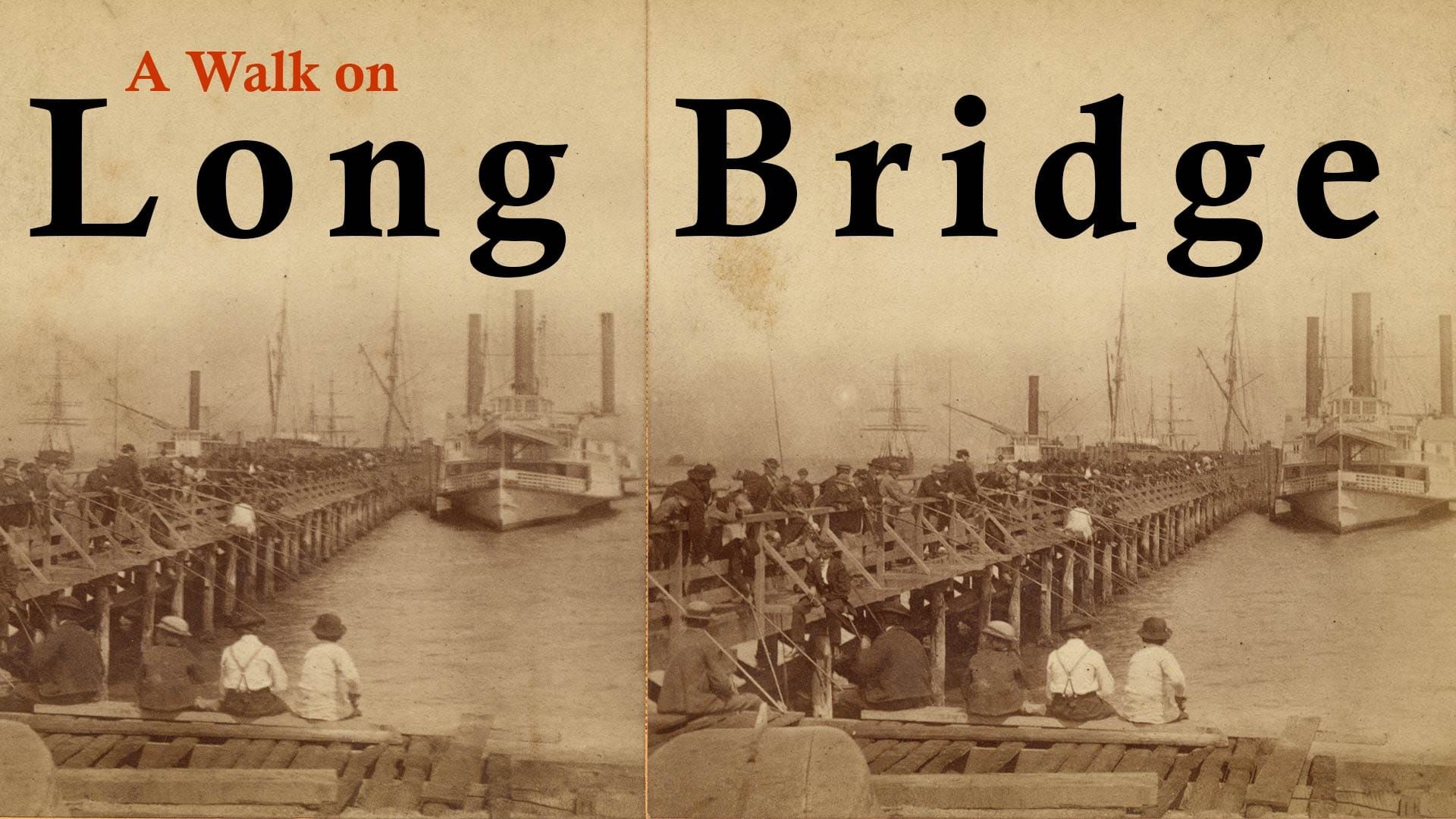
A Walk on Long Bridge
When San Francisco's Mission Bay was a bay.

I sorted mail and made copies at a communications company in the China Basin Building. I ate my lunch on a bulkhead facing Mission Creek, which I thought of as a sewage canal. It was 1992.
South of the channel everything was scraped clean. When I could afford to buy lunch, I’d cross the 4th Street bridge to eat at Carmen’s, a shack which stood on the edge of a dusty-beige landscape with angling asphalt streets and intermittent chain link fences. To walk the open ground as far as the brick fire station on 3rd Street to the southeast or the cluster of hippie houseboats* to the west meant using too much of my 30-minute lunch break.
Today, the area would all be unrecognizable to temp-job/mail-clerk Woody. There are aluminum, blue, and sienna towers, gourmet cheeses, bike racks, bubble tea, Giants fans, Warriors fans, biotech, and mini-golf.
Mission Bay has everything. Well, everything but the bay it’s named for.
One Long Bridge
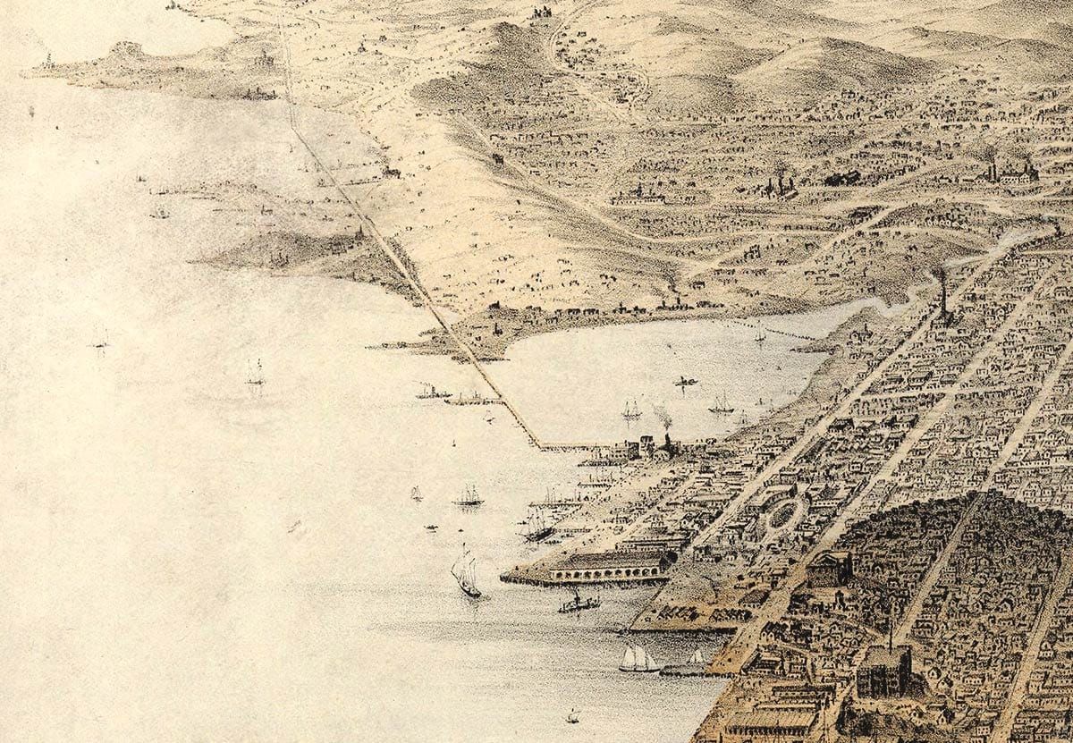
Here’s San Francisco in 1853 with a bay-in-a-bay. South of 3rd Street an ice-cream-scoop chunk is missing from today’s familiar city thumbprint:

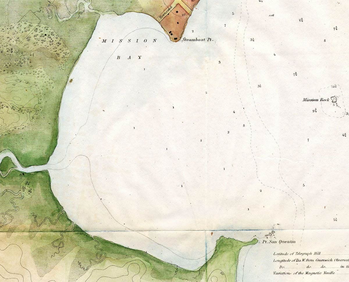
Mission Bay was mostly a marsh. Salty tides mixed with fresh water from the mouth of Mission Creek, which was navigable by shallow-draft schooners only at high water.
In the early 1860s if you wanted to go downtown south to the Potrero, you had a long, often-muddy trip around the marsh on a toll road. You endured the stench from numerous slaughter houses on the northern shoreline.
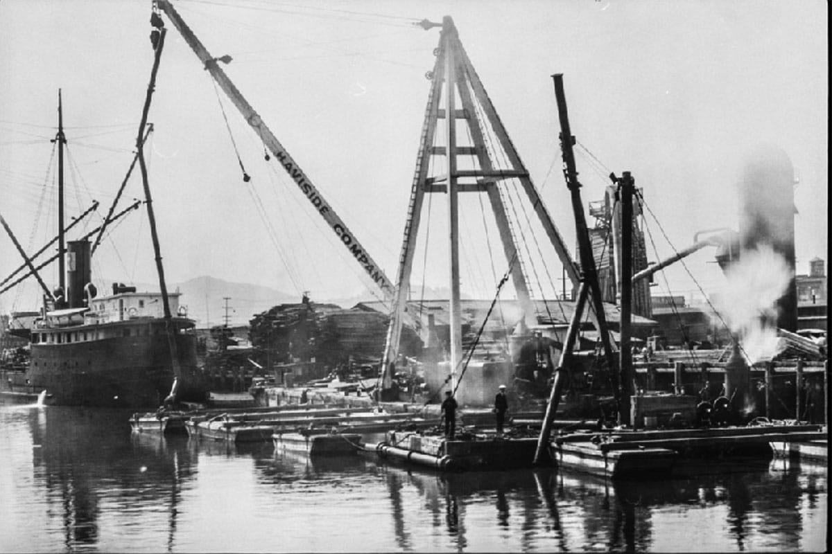
Go-getters wanted to close Mission Bay’s open mouth, bring together the fangs of Steamboat Point (now 3rd and Townsend Streets) and Potrero Point (16th and 3rd Streets) to the south. By creating an express route to new bayside industries below the marsh—powder works, tanneries, iron mills, shipyards, and a rope factory—they could connect workers to jobs, start land speculators salivating, and collect tolls for moving product.
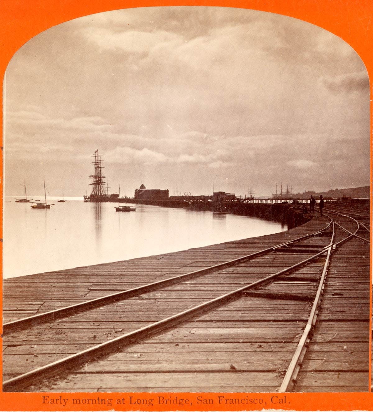
The 3,500-foot Long Bridge was built on piling across Mission Bay in 1864–65. Beginning from about where the Caltrain Station is today, the bridge extended 4th Street a quarter mile into the marsh and then angled for a straight shot at Potrero Point.
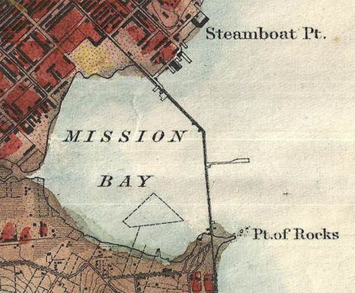
We can follow the route pretty faithfully today. But after leaving the Caltrain station and crossing the current 4th Street bridge (built in 1917), we do run into a hiccup. Long Bridge ran right through what is now the front door of Gus’s Market.
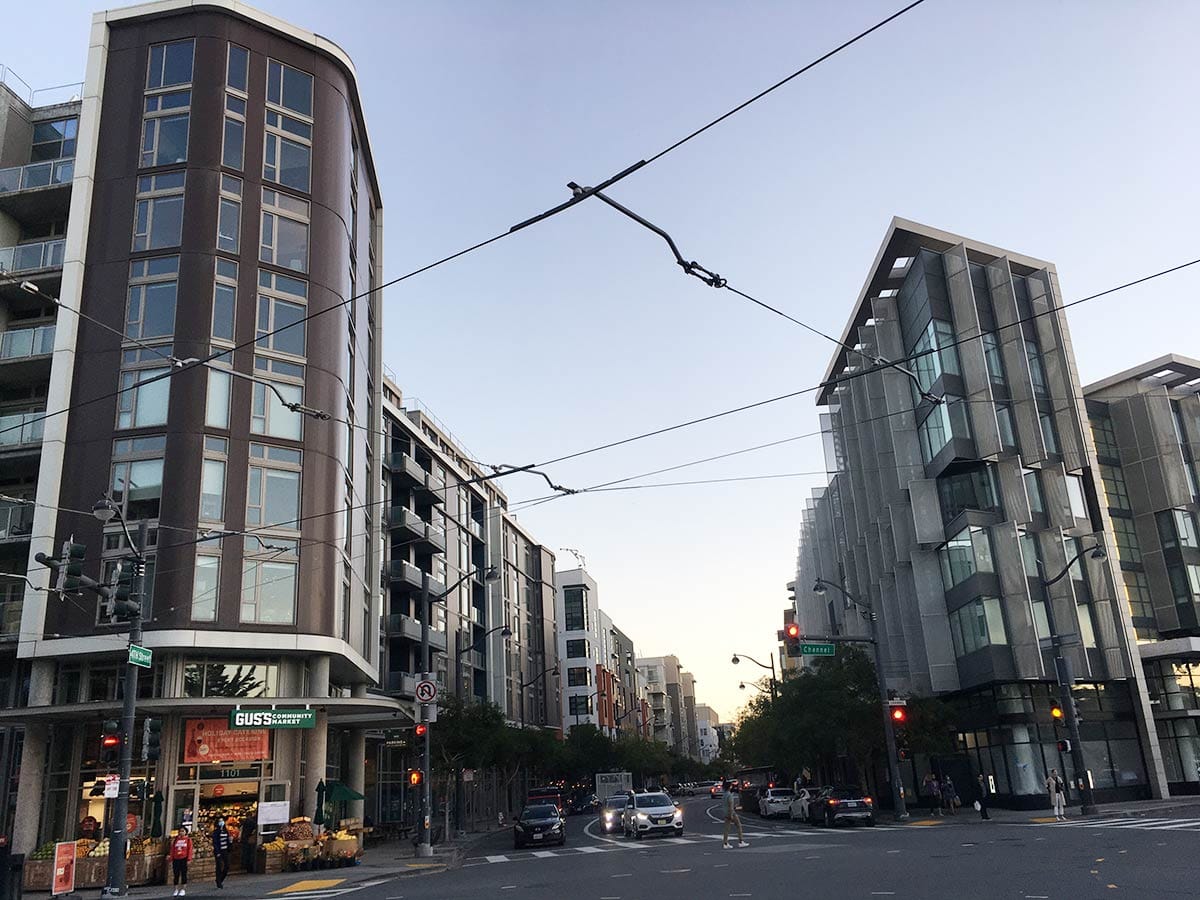
Since we can’t walk diagonally through the modern blocks, we have to take a little detour. Let’s go down 4th Street so we can make a left on… Long Bridge Street. (Thank you, recent city planners for giving us this street name.)
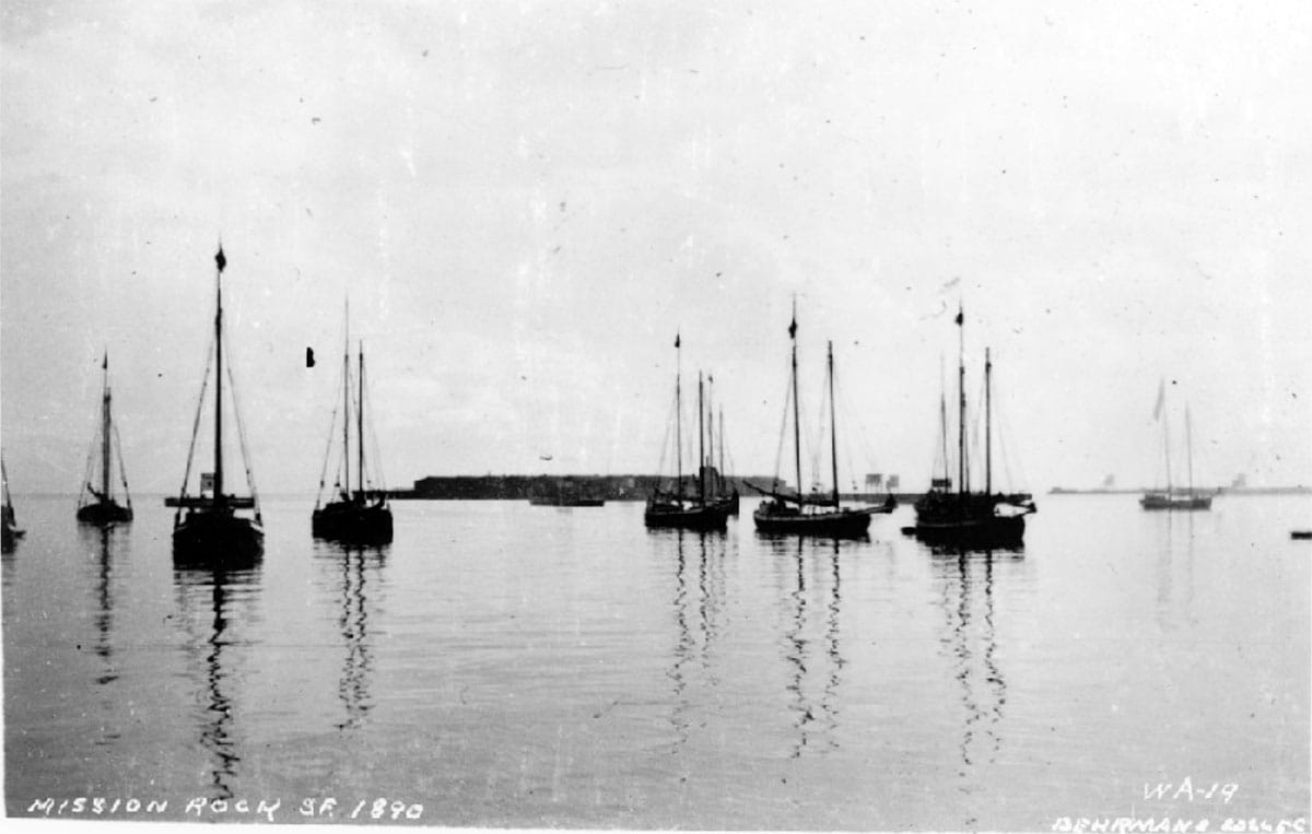
Now a right on 3rd Street, past Mission Rock Street. The street’s namesake promontory once rose 25 feet up out of the mouth of Mission Bay where the blocky end of Pier 50 is today.
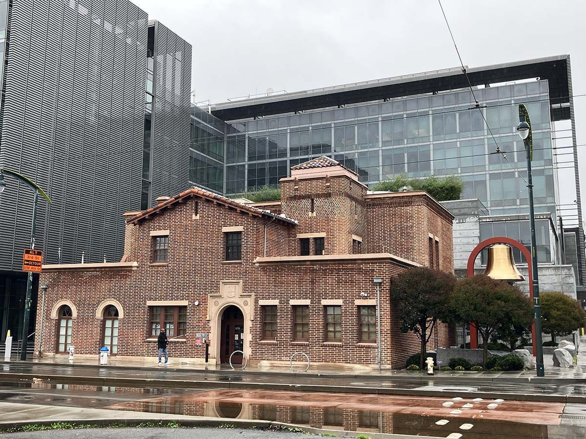
We walk a little farther south on 3rd Street and, ah, here’s a familiar site to 1990s Woody: the old Fire Station #30, where folks would bring their Toys for Tots donations. About here, Long Bridge made its angled right south.
Heading south on 3rd Street from here faithfully follows the path of the 1860s bridge. Schooners carrying hay, coal, or lumber in or out of Mission Bay would have had access through a pivoting 27-foot-wide drawbridge in the bridge center.
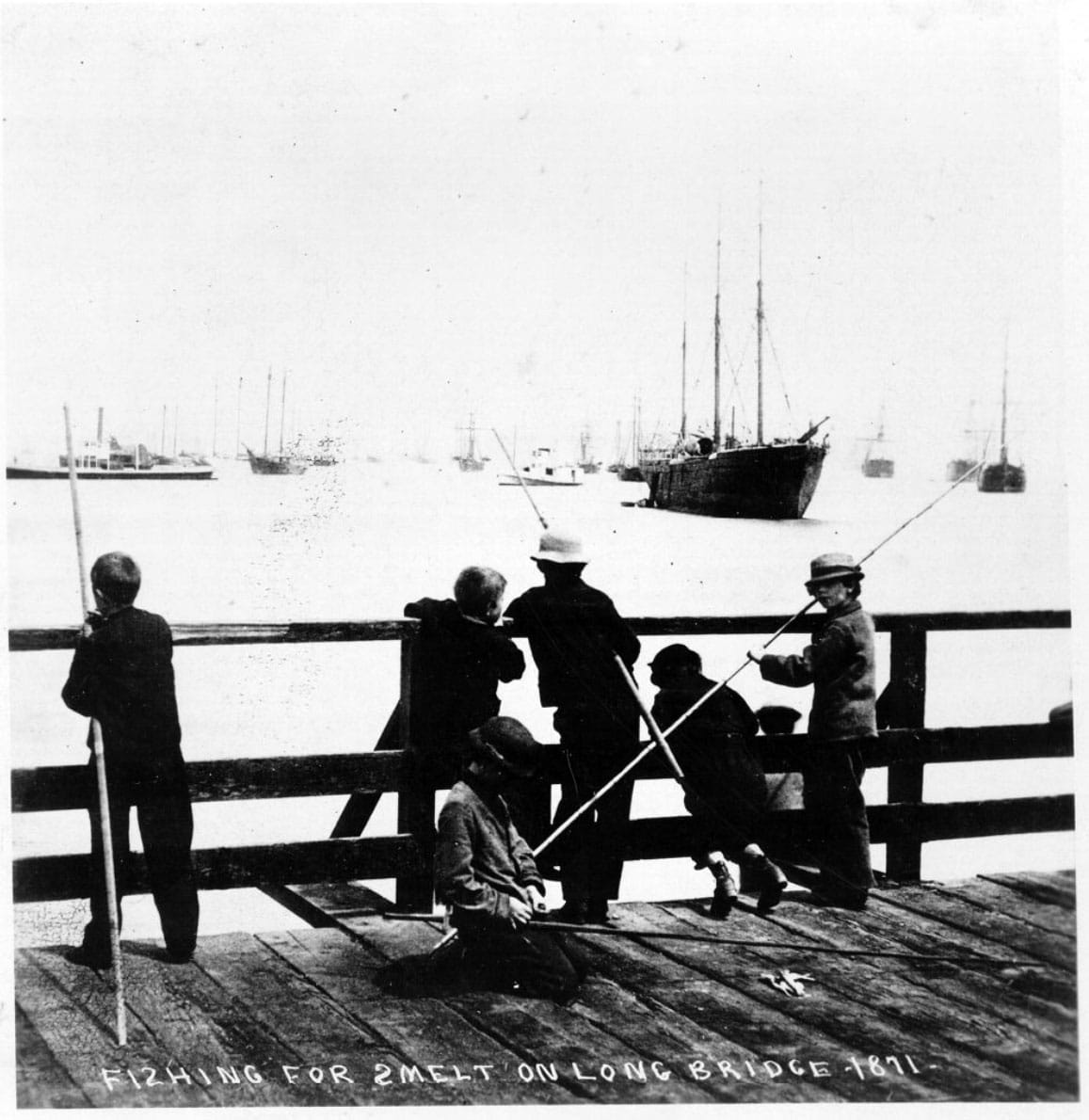
A pier named Hobbs Wharf ran perpendicularly out into deeper water. This was a great place to fish for smelt.
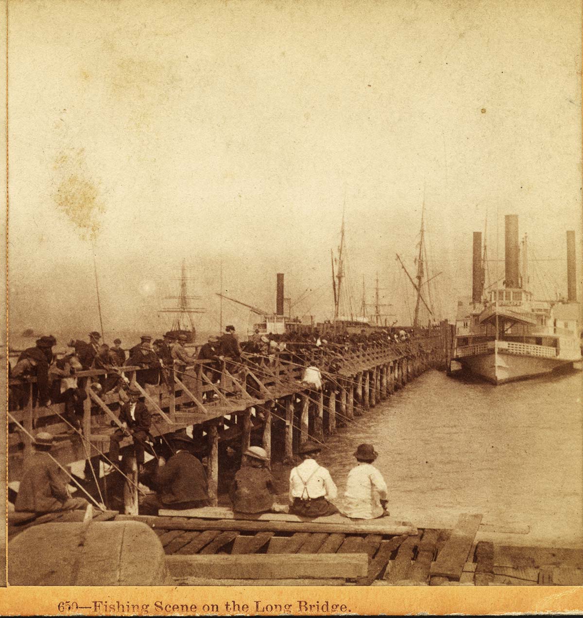
While built as a toll road for commerce and economic expansion, Long Bridge was free for pedestrians and drew South of Market folks for Sunday constitutionals to watch watercraft and boat races, and even to take a dip at a salt water bath house.
Refreshments could be had on the bridge at James Gallandett and G. W. Purdy’s “Half-Way House.” Other purveyors of victuals perched themselves on piers to sell to the strolling crowds.
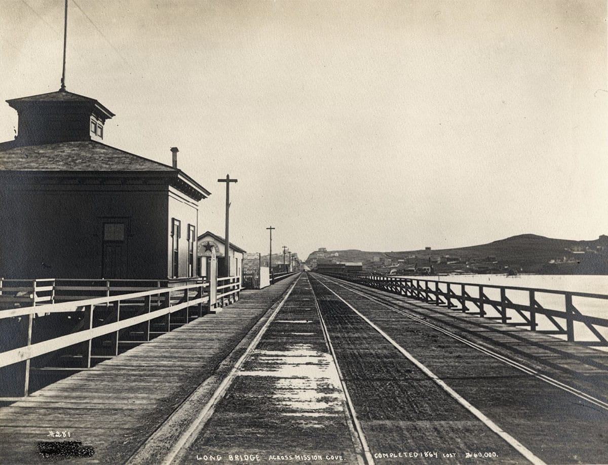
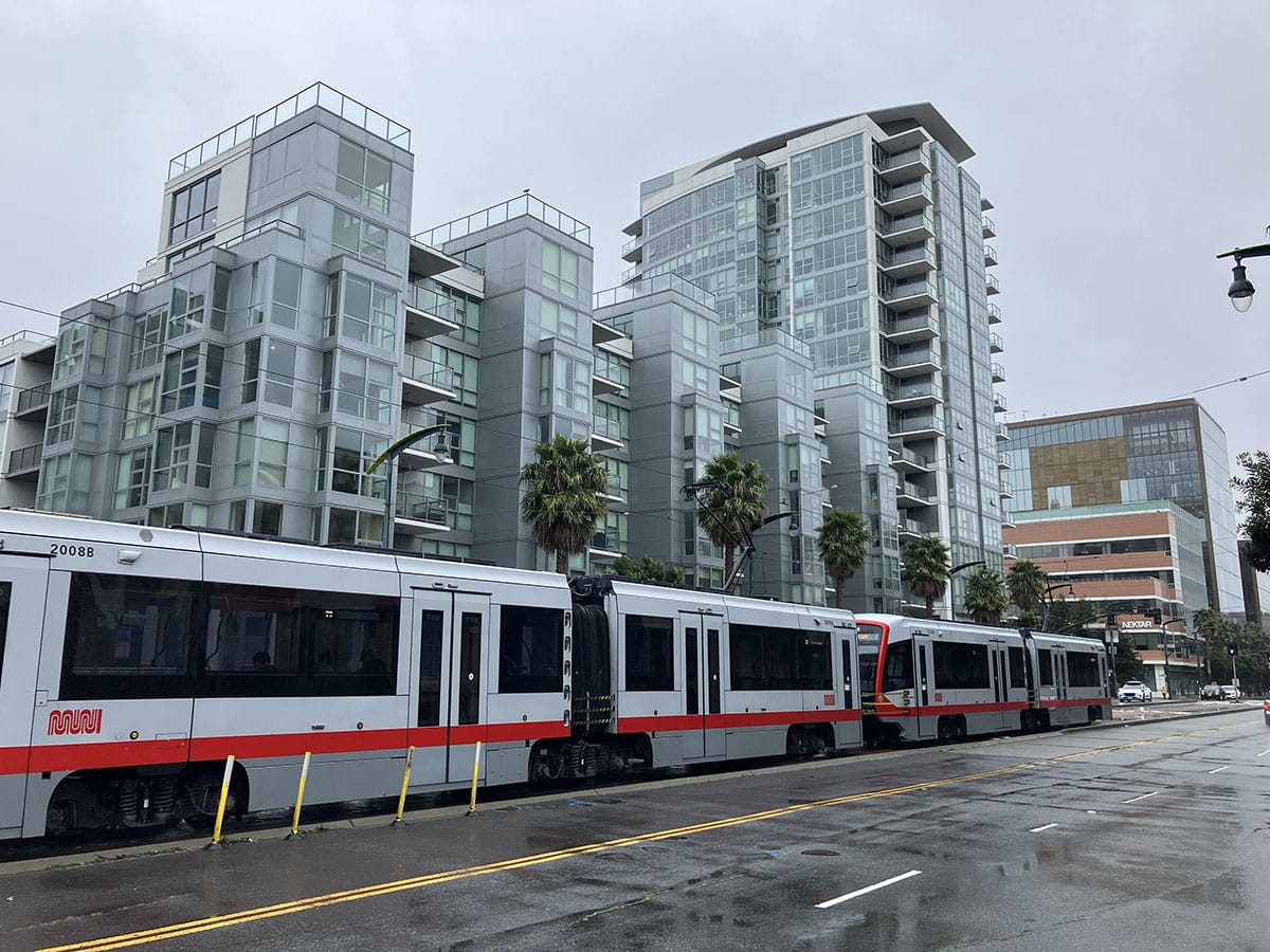
The Omnibus horse car line ran from Market Street down the full length of Long Bridge. We do not have the old wooden cars to ride, but we can pretend on the light-rail T-line.
Long Bridge hit land at what was called Point San Quentin and later Potrero Point just past today’s 16th Street.
Onward the straight road continued across Potrero land with more bridging over the Islais Creek basin until it reached a horse racing track where Bayview park is today. If we just continue walking or riding the T-line south on 3rd Street we will stay on the original path.
What today would be underwater in the era of Long Bridge? Chase Center, UCSF Medical Center, the foundations of Highway 280, soccer fields, beer gardens, Uber headquarters, and all the Starbuckses.
Bye Bye Baby
Once the enclosing line of Long Bridge was drawn on maps, it was only a matter of time that the Mission Bay oval would be colored in.
The state sold “water lots” and gave away much of the marsh to railroad companies before the 1890s. Surrounding sand hills, construction rubble, and dumped garbage did the work of “reclaiming” the bay for warehouses and rail yards. Mission Creek was diverted into the industrial channel we know today.
Over the last 30 years a new “city-in-a-city” has sprouted on the old marsh. Where steamboats were built in small boatyards, we have a baseball stadium and McCovey’s Cove. Where men once braided rope, rendered whales into oil, or rolled iron, we have modern hospitals, edgy art, and Steph Curry.
Where Woody ate Carmen Solis’s chicken-and-rice—washed down with tap water she thoughtfully provided in recycled orange-juice bottles—Woody can now buy a kale salad in a plastic box.
But does the handsome deli counter at Gus’s offer fresh smelt?
* They weren't all hippies at the Mission Creek houseboats, but I didn't know better in 1992. I soon met Jack Davis and some amazing artists there (some of whom were downright hippish.)
Woody Beer and Coffee Fund
Thanks to Mr. Angus M. (F.O.W.) and Canice F. for chipping into the Woody-and-You beverage and conversation bank. I frequently state that this is not a nonprofit fund, but it could be. What is more important to a vibrant society than human connections? And, for that matter, what is more important than Woody LaBounty having easy access to coffee and beer?
Is it your turn? Let me know when you’re free.
Sources
Nancy Olmsted, Vanished Waters: A History of San Francisco’s Mission Bay, 2nd. ed. (San Francisco: Mission Creek Conservancy, 2010). This is a great book and kudos to Chris Carlsson and Bob Isaacson for their work on the second edition.
“The Mission Bay Bridge,” San Francisco Bulletin, June 9, 1865, pg. 3.