
Precita Valley's Park
From garbage-pit-swamp to a Bernal oasis.

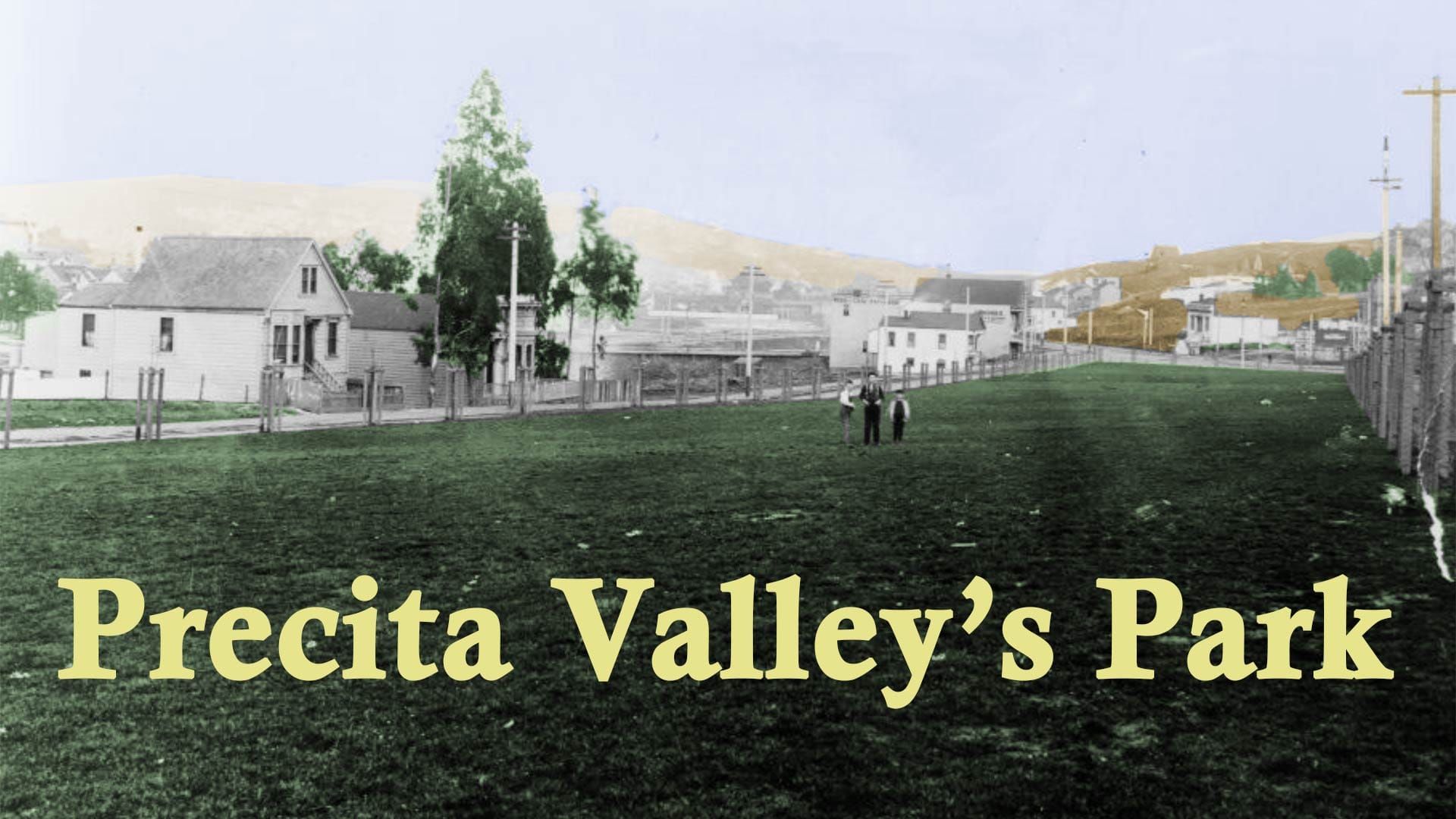
Precita Park, which lies between the northern arms of Bernal Hill and just south of Army Street/Cesar Chavez Street/Let’s-See-What’s-Next Street in the Mission District, is technically not one of San Francisco’s oldest parks.
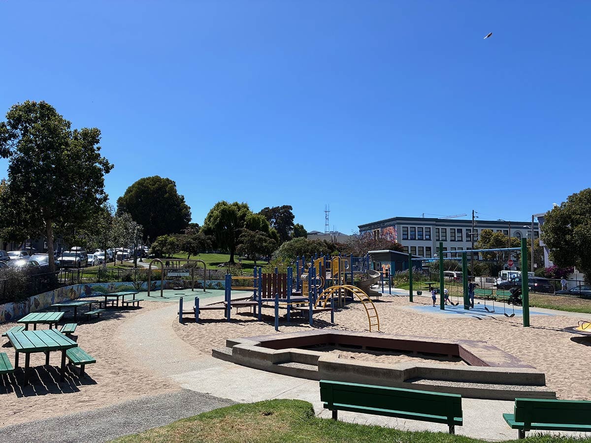
It was not until 1894 that the Board of Supervisors—responding to strong agitation from neighbors who were also fighting for streetlights, sewers, and a public school in the area—officially designated the rectangle between Alabama Street, Folsom Street, and a split-up Precita Avenue as a city park.
But unofficially, Precita Park was planned almost 40 years earlier, a decade before Golden Gate Park, when Bernal Hill and the land on its north slopes were surveyed as “Precita Valley.”
Old Pasture
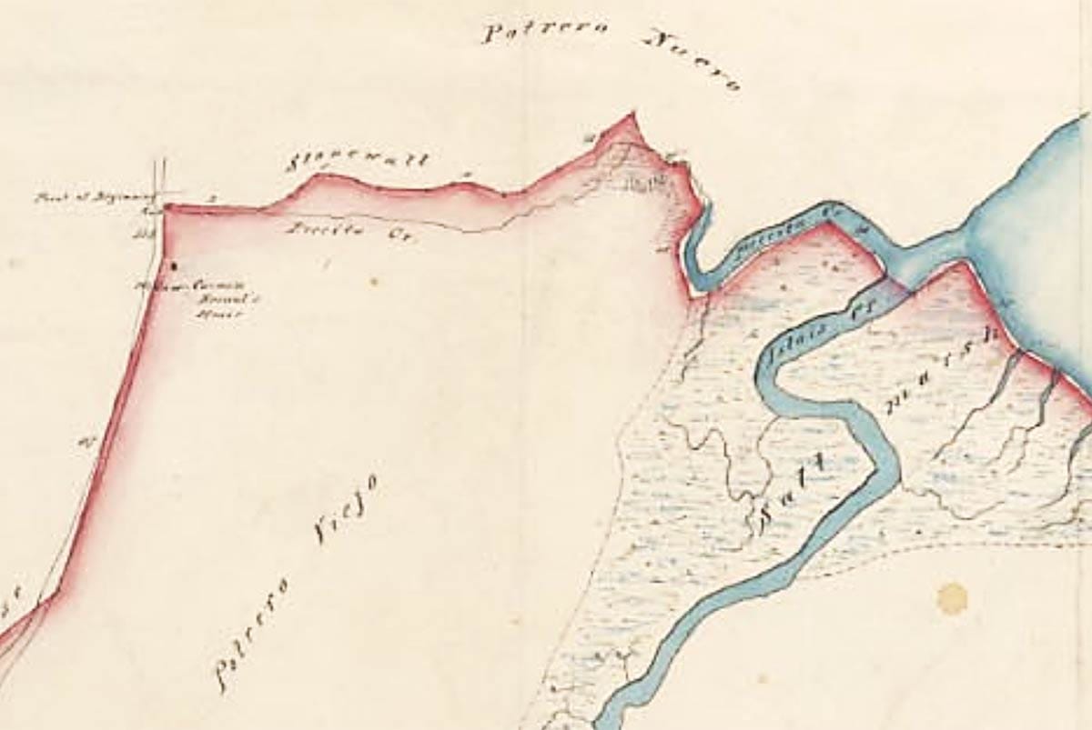
Under Mexican occupation, the area around Bernal Hill was known as Potrero Viejo, an “old pasture” for cattle grazing. To the northeast was Potrero Nuevo, a new pasturage, with part of its name still alive thanks to our modern-day Potrero Hill neighborhood.
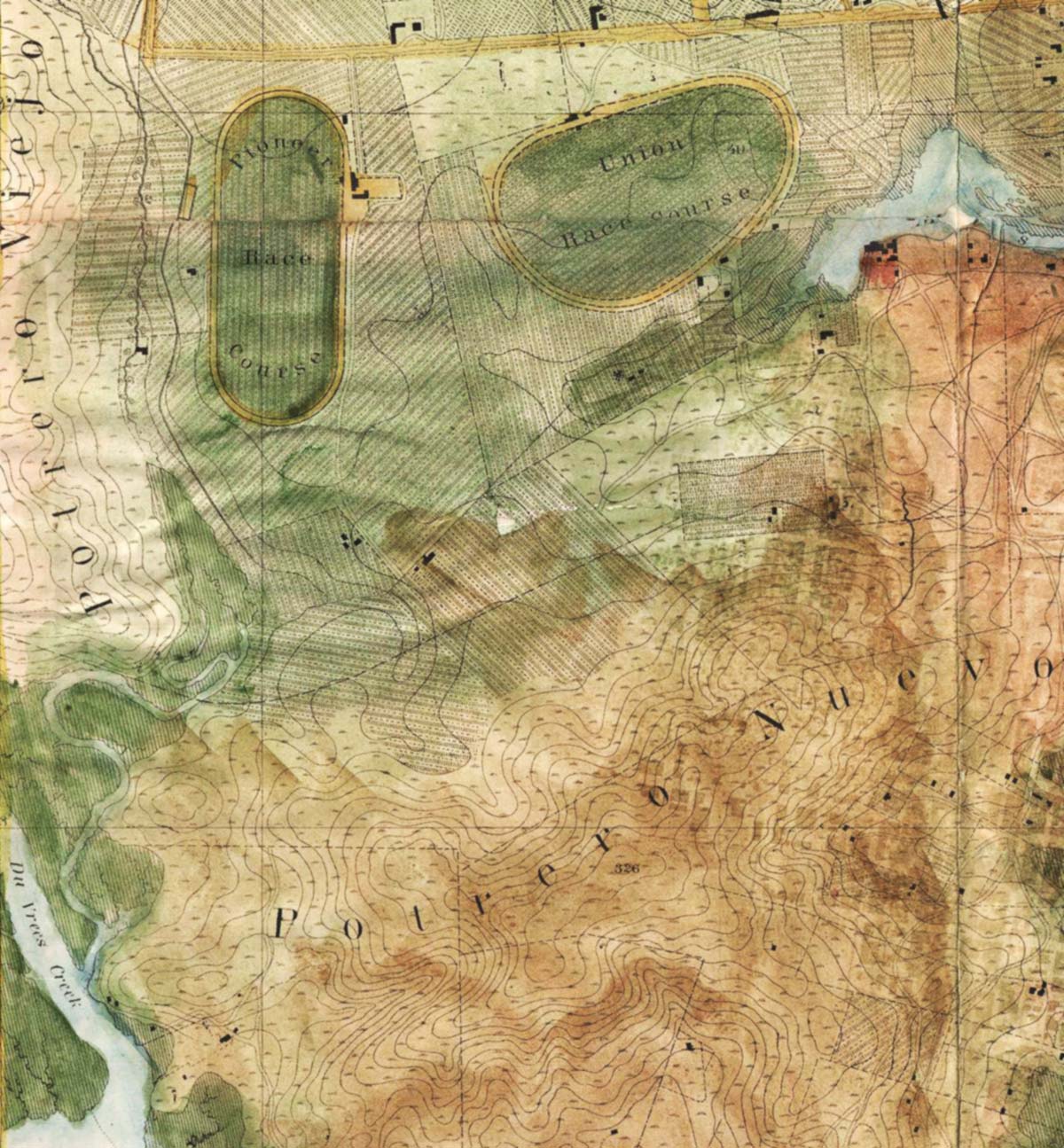
The old pasture lay in a ranch granted to José Cornelio Bernal by the Mexican government in 1839. The separator between the old and the new grazing land was along the line of Precita Creek to where it joined up with Islais Creek and flowed into the bay around today’s Bayshore Boulevard and Highway 101. Let’s flip the view with a different map and put north on top:
Hundreds of Americans arrived as part of the United State 1846 conquest, then thousands more for the 1849 Gold Rush, then many, many more by the early 1850s. Gold-mining mania quickly shifted to land-speculation mania.
In 1859, surveyor Milo Hoadley carved the gullies and ridge lines between Bernal Hill and Precita Creek into slices—at least on paper—to offer hundreds of narrow lots up for auction as the Precita Valley Lands.
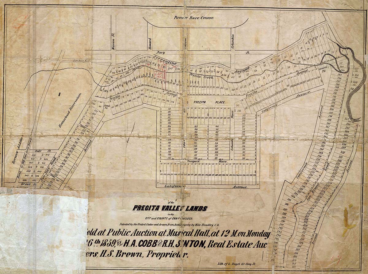
“These lands, for beauty of locality, commanding scenery, and fertility of soil, are not surpassed in the city and county of San Francisco.” —H. A. Cobb and R. H. Sinton, Auctioneers, 1859.
Today’s Bernal residents may find themselves struggling to identify anything familiar on this map, so let’s do some wayfinding. The path of Mission Street on the left, while much widened, is fairly accurate as San Jose Road on the Hoadley map.
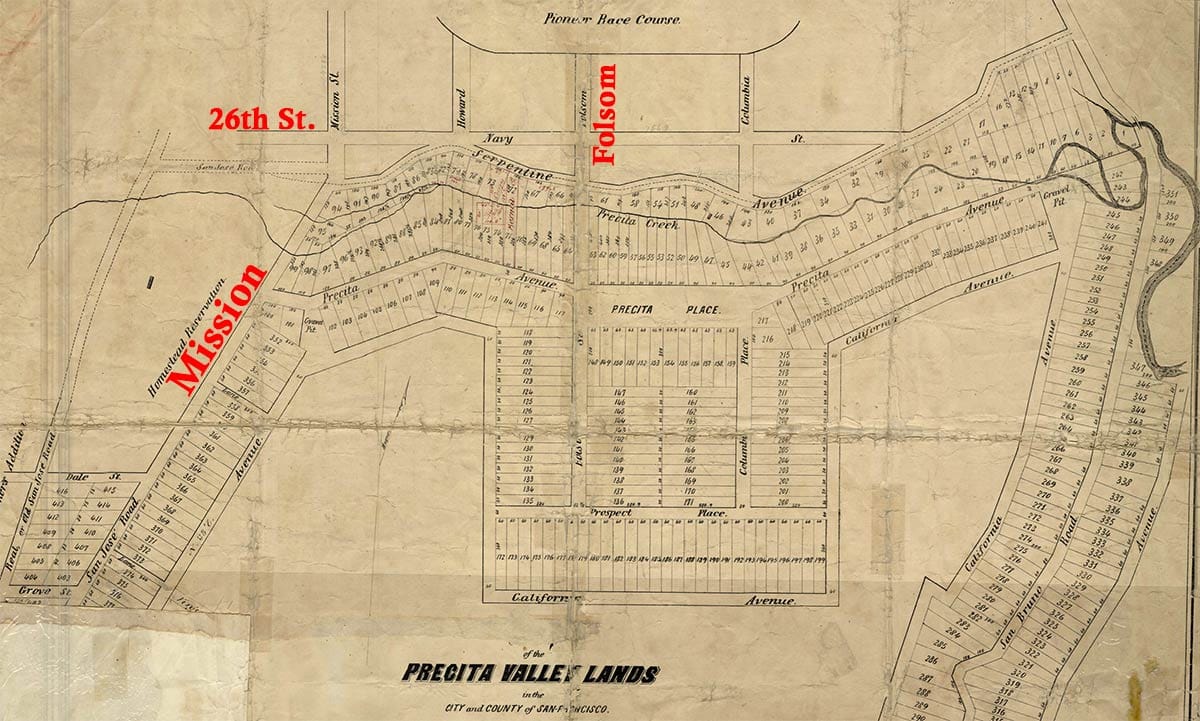
Up top, Navy Street is now known as 26th Street, intersected by Mission, Howard (South Van Ness), and Folsom streets, with Columbia renamed as Alabama Street. Yes, there was a horse-racing track, the Pioneer Race Course, but we will save that for another San Francisco Story.
Map-makers working for auction houses often ignored hilltops, canyons, rivers, swamps, and shorelines in favor of maximizing lots for sale, so Hoadley brazenly drew a tidy town plan right over the top of bumpy Bernal Hill.
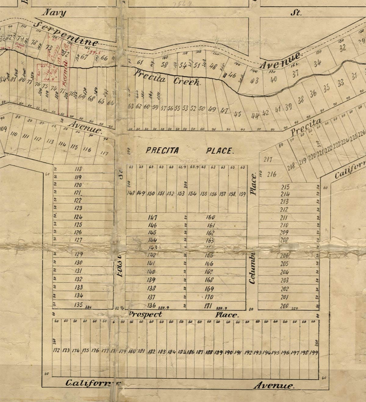
East-west “Prospect Place” roughly lined up with today’s Ripley Street, but the creation of the rod-straight southern line of California Avenue would have required eradicating the hilltop.
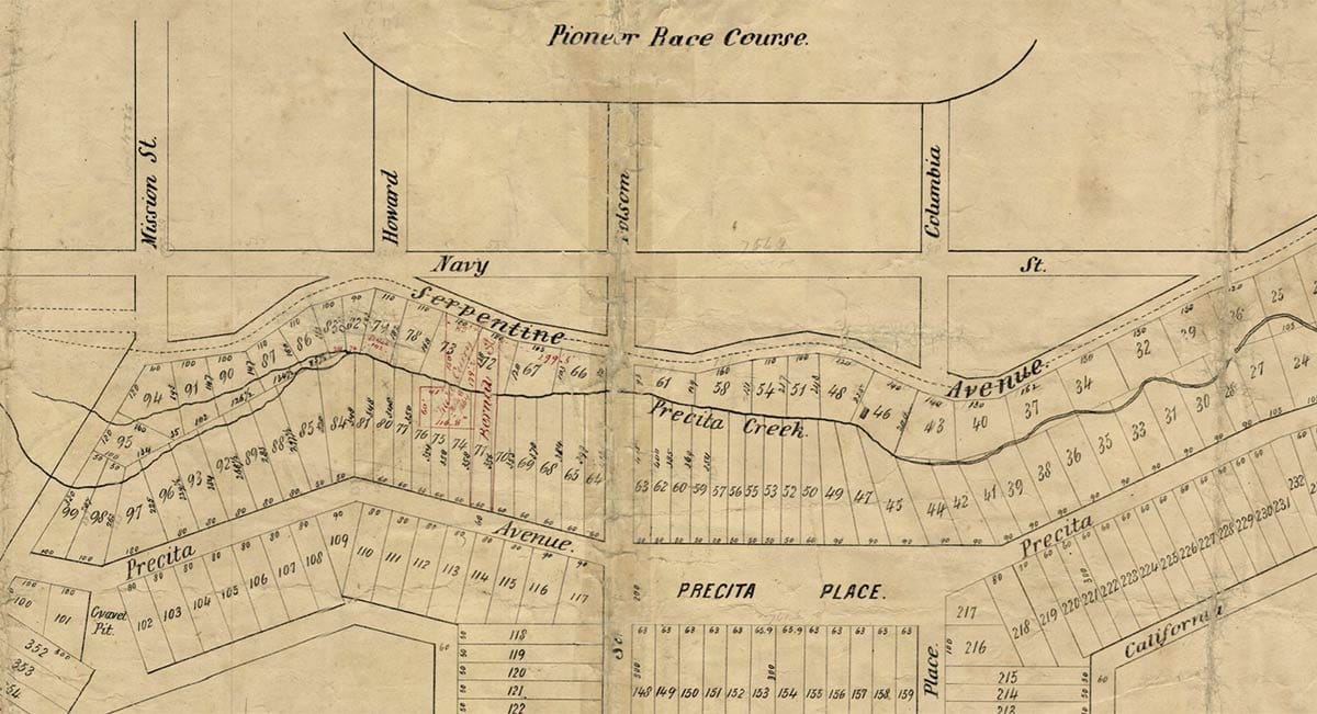
Hoadley did zig-zag Precita Avenue to work with the foothills and the creek bend before running it into a rectangle of public space he named “Precita Place.” This is the park that would take 40 years to become official.
Improving Precita Valley
The 1859 auction went well. More than 400 of the Precita Valley parcels were sold at an average price of $84 (close to $3,400 each in 2026 money). Buyers saw significant appreciation of their investments in the resale market.
Other speculators and surveyors combined and re-sliced and re-mapped the hill with interceding streets. Some of the names of these development ventures remain with us—Peralta Heights and Bernal Heights—while others, the “Barman Tract” and “Cheeseman’s Map #1,” do not.
Most purchasers were not looking to build or live on the land, but just hold, trade, and sell the lots. The Board of Supervisors took years to officially declare many of the streets “open.”
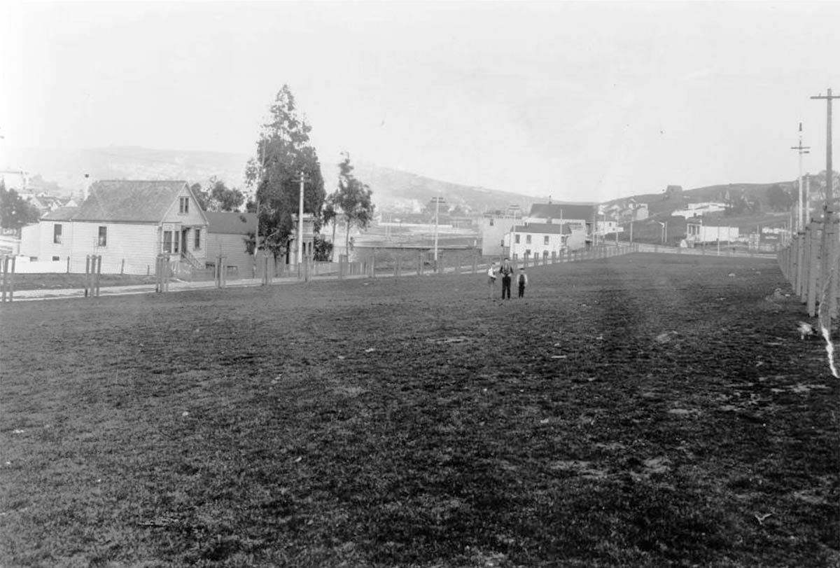
For the rest of the century, Hoadley’s map of beautiful roads and hundreds of parceled-out lots still looked like and were used as pastureland, as small dairies and hog ranches took advantage of loose livestock restrictions in Precita Valley and Bernal Heights. An operator could own just one or two 25-foot-wide lots, but let his cattle roam around to graze and defile the land of neighbors.
In 1895, the Call decried that, because of the roaming livestock, “women and children have been killed or maimed, and private property has been invaded and destroyed, and the settlement of the region retarded.”
While cows ran amok, Hoadley’s Precita Place remained a park only in concept. The rectangle was a natural hollow and overflow spot for Precita Creek. In dry seasons it was a garbage pit. In wet seasons it was a garbage-pit swamp overrun with frogs and sewage slime.
Into this hollow flowed effluvia from tanneries along the creek, backed-up run-off from slaughterhouses on the east, waste from grazing cattle, and sewage misdirected from the county hospital.
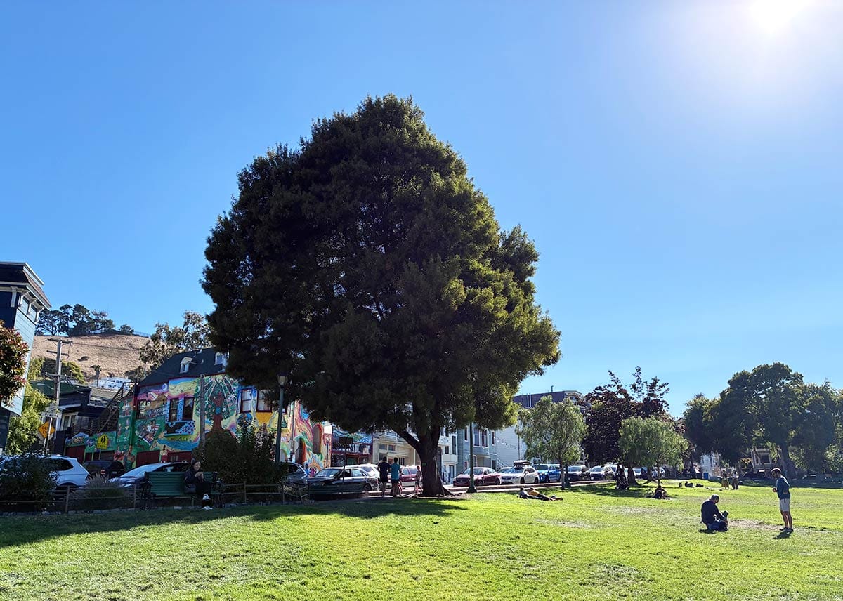
Progress made the problem worse. When adjacent streets were leveled out to city-defined grades, some parts of the bottom of the Precita Place pit ended up 30 feet below sidewalk level. The Board of Supervisors designated the dump “Bernal Park” in 1894, but somehow that didn’t make it one.
John T. Graham, who ran a grocery at Precita Avenue and Alabama Street on the banks of the supposed park, called it “one of the worst cesspools I ever saw […] filled most of the time with a slimy ooze. It is enough to give a man the ague to look at it.”
Graham had organized with other neighbors in the 1890s to form the Precita Valley Improvement Club. They delivered a petition to the supervisors demanding the city either fill in the garbage-pit-swamp-park or “turn it over to the Fish Commissioners before the winter rains set in, as it will then be in fine condition to be used as a fish hatchery.”
Petition sarcasm and nagging eventually got results. In 1899, the big pit was filled in. It took two more years of prodding, but, in 1901, park superintendent John McLaren oversaw the installation of pipes, sod, and trees. When the improvement club asked for some benches, the Park Commission authorized logs to be dumped onsite, as benches were expensive.
Sometimes you take what you can get.
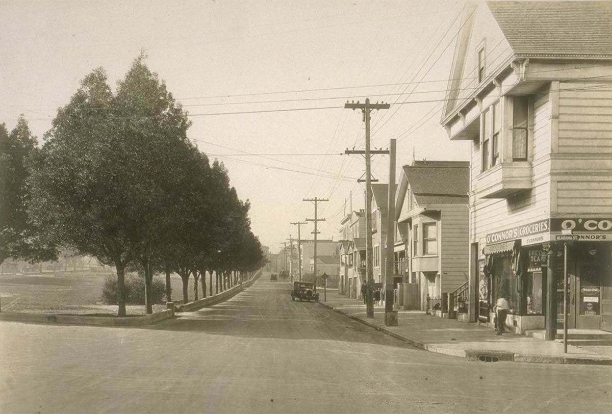
Precita Park
You might be surprised, but turning a garbage-pit swamp into a park was a popular move. In 1904, the Examiner noted a big increase in construction around what started to be called Precita Park: “Into the Precita valley and up on to the high ground of Bernal Heights, the workingmen of the city are building houses for themselves and their families.”
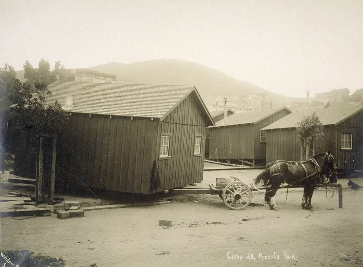
The blue-collar character of Precita Valley solidified when a refugee camp was created in the park after the 1906 earthquake and fire. Lots of factory men, carpenters, teamsters, and their families burned out of South of Market and the Mission were drawn to the cheap Bernal lots. An earthquake relief cottage moved out of the camp made for a good instant starter home.
There was still an affordable feeling to the neighborhood into the late 1980s and early 1990s.
Nancy (W.O.W.) rented on Ripley Street when we first started dating. Precita Park then was…fine. There were occasional shootings, yes, but lots of very community-minded folks were dedicated to making the park better. There was a chill confluent vibe of Latinx and hippie cultures.
Folks priced out of Noe Valley had found the Cortland Street corridor but hadn’t quite discovered the north side of the hill. We might have a date night at Café Cozzolino. Precita Eyes studio felt like a neighborhood secret we needed to keep. The park was a good location to see the Mime Troupe’s annual production.
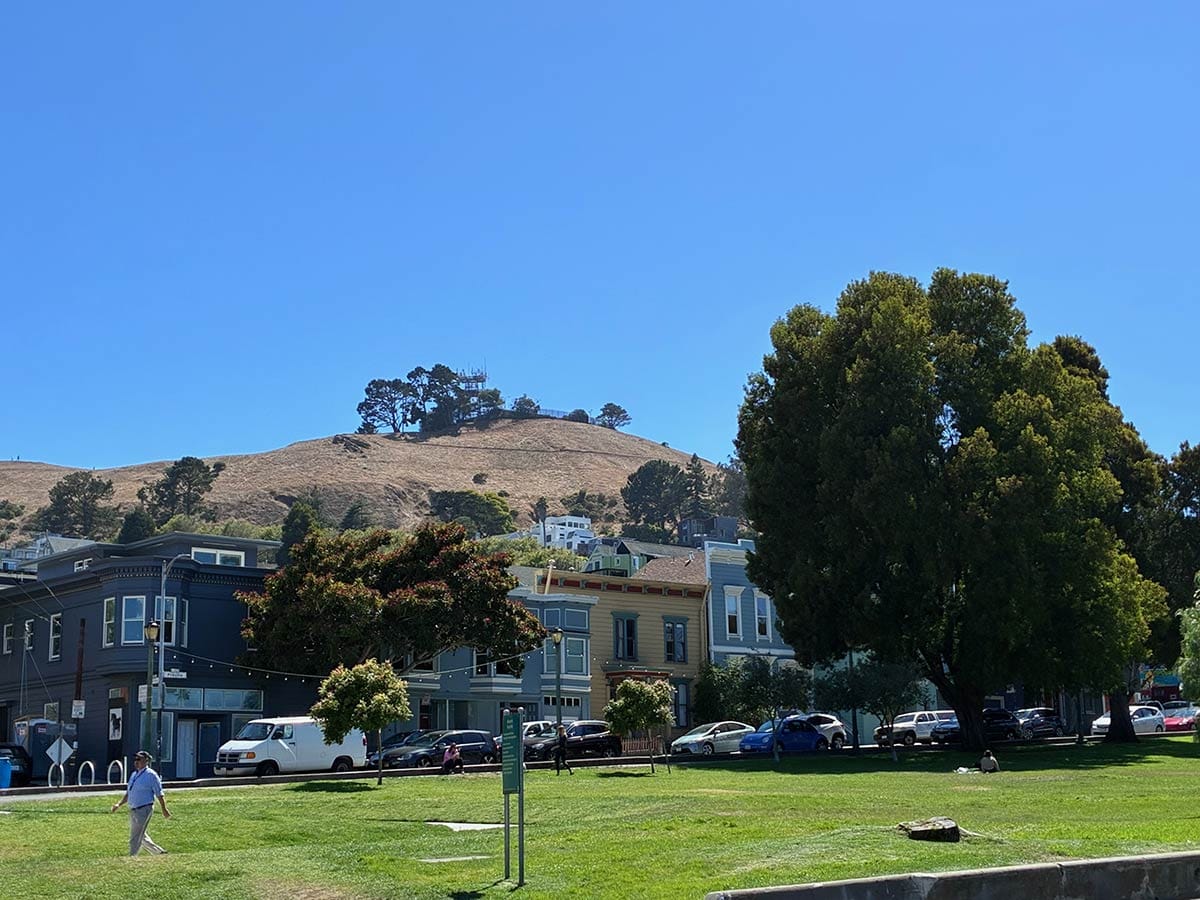
By the early 2010s, there were still occasional shootings, but gripes were primarily about off-leash dogs, parking, loyalties to the lattes at Charlie’s on Folsom over Precita Park Café on Alabama (Charlie’s man here), and how old gentrifiers kept complaining about new gentrifiers.
Probably it’s just me, being 60 and a guy who lives on the other side of town, but there’s a pleasant good-feeling equilibrium at Precita Park these days. The playground is awesome. Weekends are jumpy houses and dogs chasing frisbees and lovers canoodling on blankets.
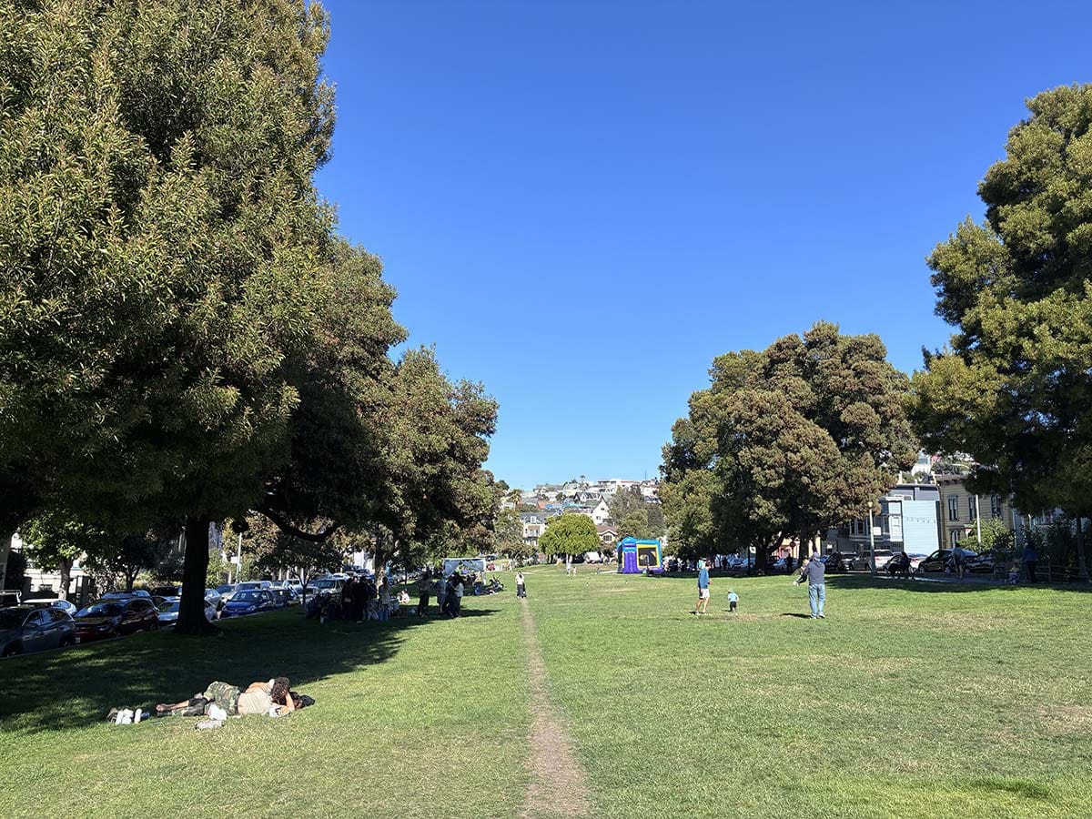
Precita Park may not be in the affordable working-class neighborhood it once was, but at least it’s no garbage-pit swamp.
Woody Beer and Coffee Fund

Because we are wary San Francisco people we should still bring our coats, but what do you think about having a drink with me outside somewhere? The weather has been great. Wonderfully generous people have contributed to the Woody sociability fund to set us up, so your beverage of choice is paid for. We just need to get this on the calendar!
When are you free?
Sources
“The Precita Valley Sale,” Daily National Democrat, September 29, 1859, pg. 3.
“A Gross Outrage,” San Francisco Call, December 10, 1895, pg. 6.
“Dislodging the Frogs,” San Francisco Call, May 2, 1897, pg. 15.
“Want Open Streets,” San Francisco Call, August 28, 1897, pg. 7.
“Polluted by Foul Odors,” San Francisco Call, October 17, 1897, pg. 16.
“Bernal Park,” San Francisco Call, February 8, 1899, pg. 9.
“Ordinance Regulating Use of Automobiles,” San Francisco Call, February 6, 1904, pg. 7.