
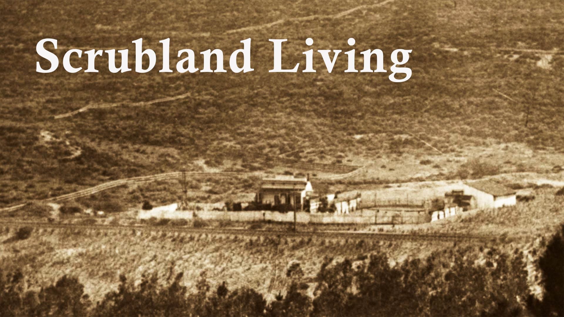
Scrubland Living
In the 1860s, Cornelius Reynolds and his family took on San Francisco's scrubby west side.
Cornelius Reynolds likely was a man who enjoyed alone-time, if not from his family, then at least the rest of the world.
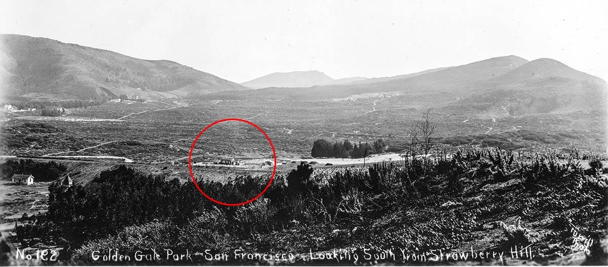
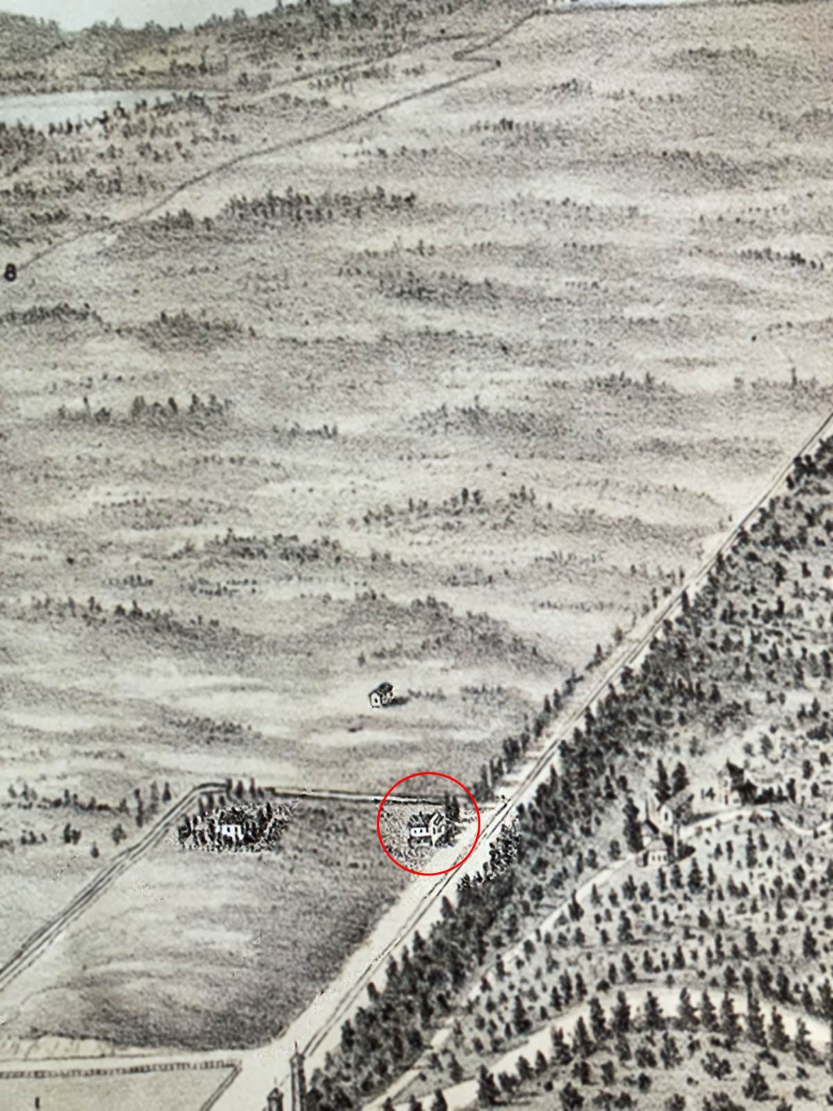
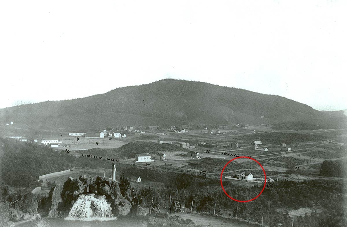
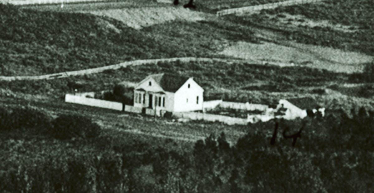
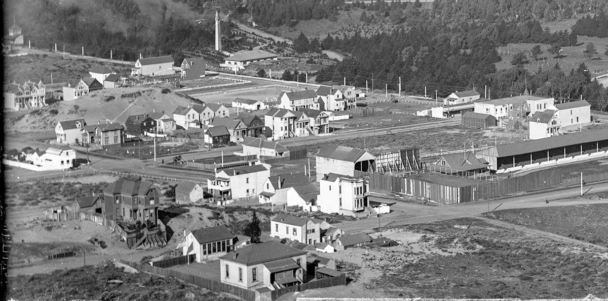
Sometime in the 1860s the immigrant from Wiltshire, England homesteaded in the scrub and sand dunes of western San Francisco with mostly jack rabbits for neighbors. We can see his house in this wonderful Charles Turrill photo of the future Inner Sunset District in the mid 1880s:
Let’s take a closer look at the Reynolds homestead in a cropped duplicate:
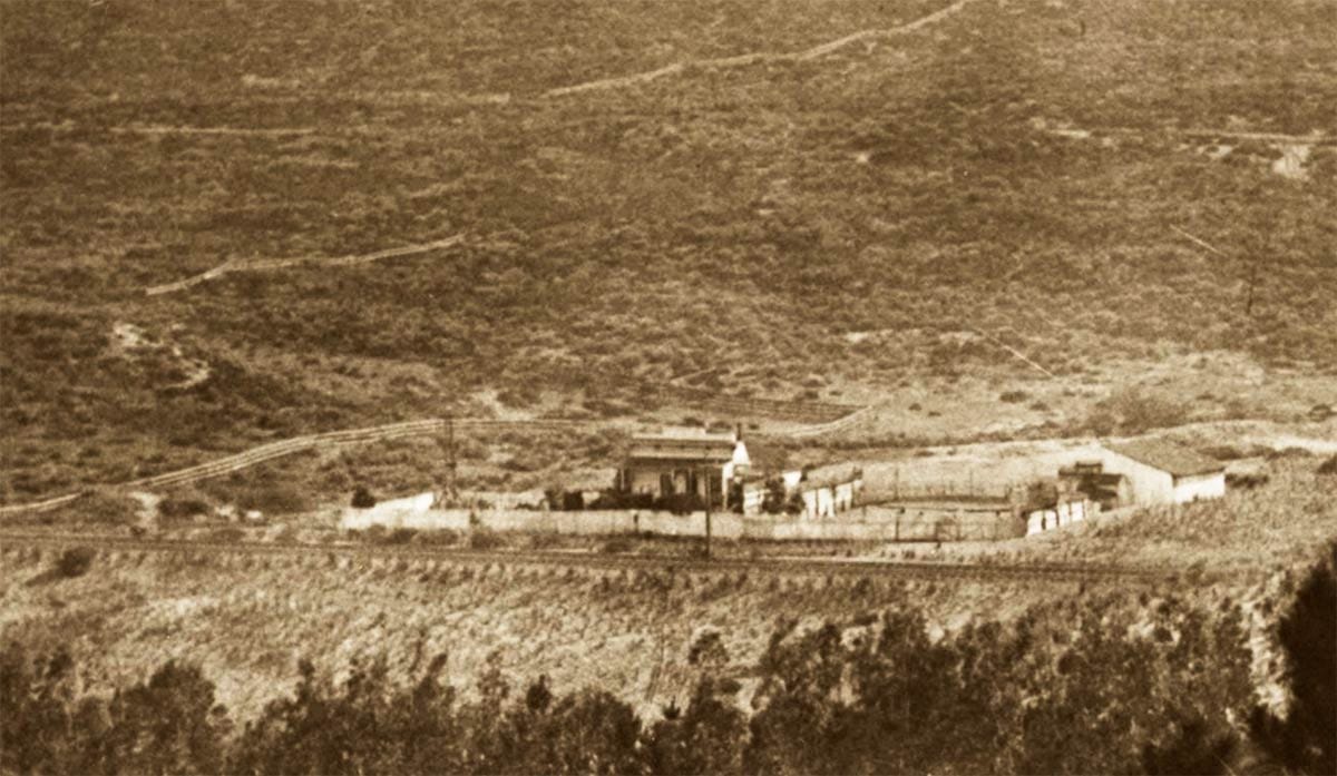
What does one do, so removed from society on scrubby dunes in the 1860s? There was no electricity, gas, or sewer hook-up, and, as you can see, very little nearby company, even in the 1880s.
Reynolds ran a hog ranch on his scrub patch. In the 1870 U.S. Census he reported owning real estate worth $1,000 as well as two horses and 70 swine worth $700. He likely had drilled a well for water, tapping the west side aquifer.
A meandering half-circle-path did run past the Reynolds property from Ocean Beach through the future Richmond District and south through the future Sunset District to Lake Merced. It followed the “drift lines” of sand dunes.
To the south of his home, a more formal “Central Ocean Road” slithered from today’s Haight through the Sunset District to Lake Merced.
So, the Reynolds family—Cornelius, his wife, Mary Ann, and their children Martha, James, Eugene, and Frank, had some connections to the wider world, lonely as they might have been.
In addition to being set among shifting sand hills, the Reynolds property stood on shaky legal ground. In the 1860s, San Francisco’s official western edge was Divisadero Street. The federal government, city of San Francisco, land speculators, and individual homesteaders like Reynolds all asserted different and contested claims to the foggy “outside lands” to the west.
Old Mexican maps and deeds were mysteriously produced by claimants, filed for title, sued over, accused of being forgeries, and both furiously decried and defended. Men threw up fences to strengthen their claims and other men tore them down in the night.
In 1866, Congress straightened it all out with the Outside Lands Act, granting most of the land to the City of San Francisco while reserving key sections for federal use (such as Fort Miley, and other key defensive positions facing the water).

The city hashed out settlements with squatters and homesteaders, offering clear title in exchange for conceding parts of their claims for public roadways, school sites, and a vast new public recreation ground, Golden Gate Park.
This went easier than you might think. Land in the sandy west was only valuable with the promise of city streets and infrastructure. Most people couldn’t cut Cornelius Reynolds’ lifestyle. The biggest enterprises in the Reynolds’ neighborhood beyond hog and dairy ranches were a couple of dynamite factories that had a disturbing tendency to explode.
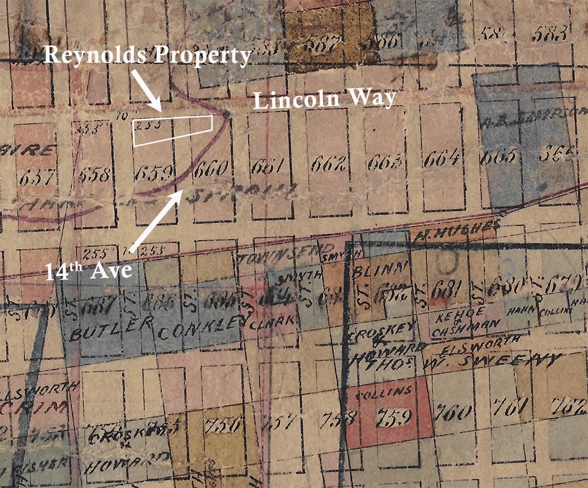
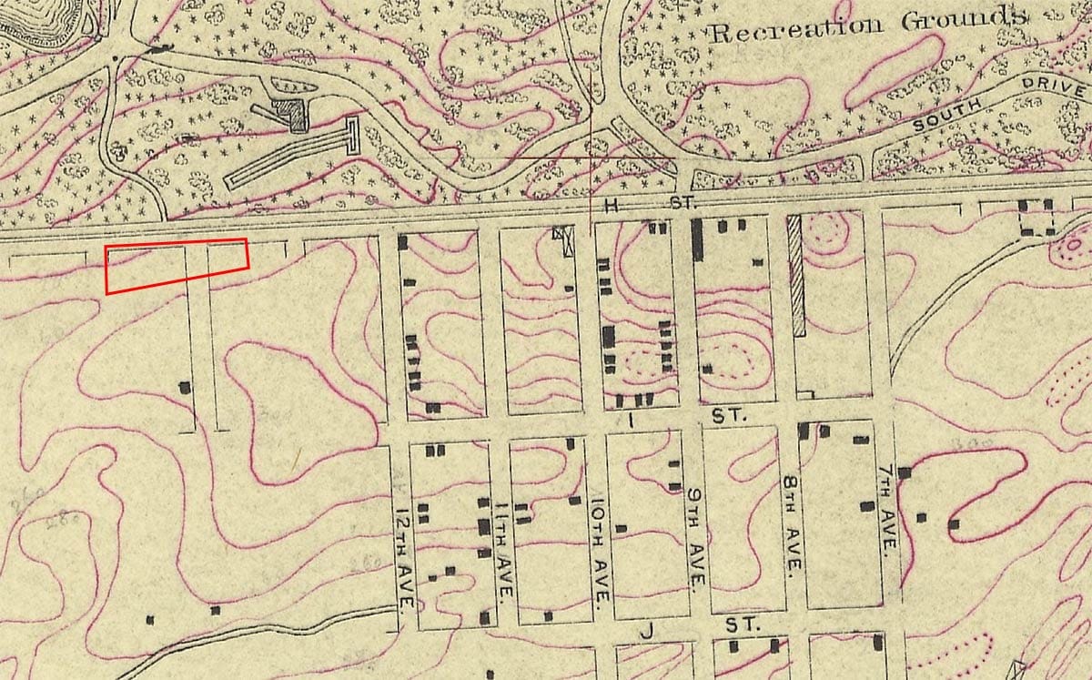
So, in 1870, Reynolds had his claim validated and acquired a more specific address. He was acknowledged to own a wedge of land along H Street (Lincoln Way) between 14th and 15th avenues and a smaller aligned wedge between 14th Avenue and today’s Funston Avenue. (He had to grant the intervening section to the city or there wouldn’t be a 14th Avenue.)
Golden Gate Park took years to make. Reynolds was hired as a park laborer in that effort. The Park & Ocean Railroad was created along Lincoln Way in 1883, and Reynolds got a job as a watchman. (Someone had to clear the frequently shifting sands off the rails.) Later his son, Frank, half-a-foot taller than his dad, became a conductor and electrician.
Taking advantage of being near two of the only paths through the dunes, Reynolds ran a small saloon on his property for a spell in the 1870s and 1880s, which must have brought some company to the homestead.
Daughter Martha married teamster Charles Dietz, moved to the South of Market neighborhood in the early 1870s, and had three children. Son James became a shoemaker and later had his own cottage on the ranch. Eugene and Frank, the youngest children, attended Laguna Honda School, which stood next to another roadside saloon.
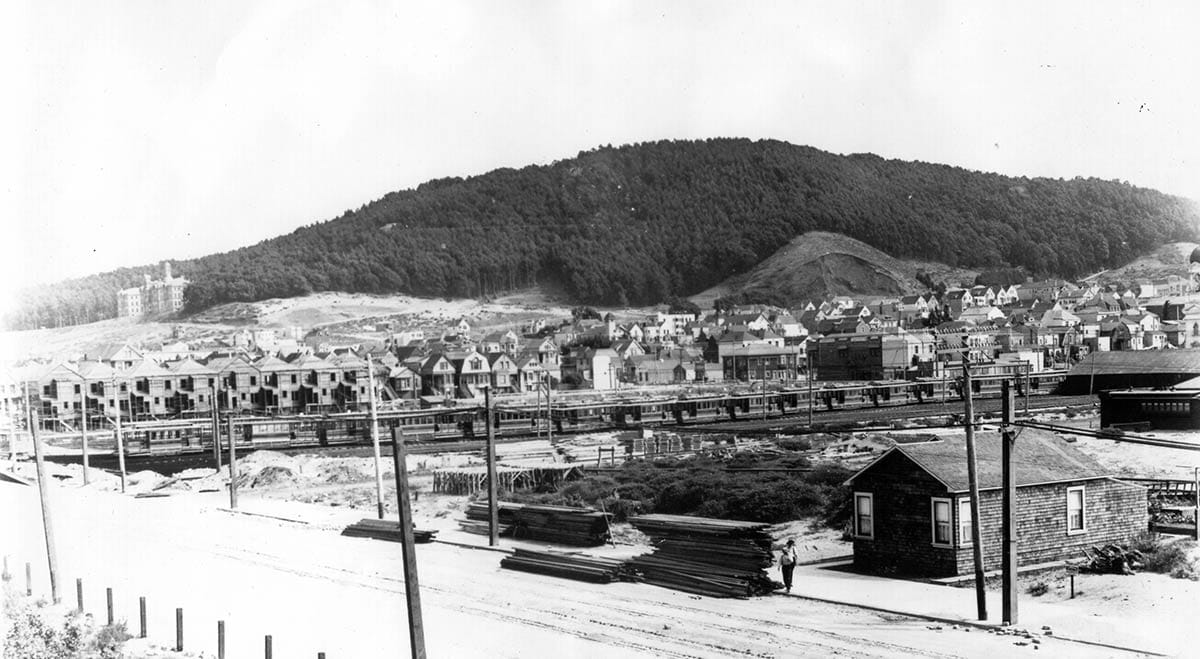
Golden Gate Park’s Midwinter Fair in 1894 sparked the first real interest in developing the Inner Sunset District, which didn’t have an official name yet. (Real estate speculators tried on “South Side,” “Parkside,” and “South of the Park” before Sunset took prominence starting in 1895.)
While development grew modestly around the fair entrance at 9th Avenue, it must have seemed to Cornelius Reynolds like he was now on the edge of Manhattan compared to the 1870s.
Cornelius was a member of the Independent Order of Odd Fellows (I.O.O.F.) fraternal organization and it was in the Odd Fellows cemetery in the Richmond District that he buried his two sons, James and Eugene, who died at 38 and 27 years old respectively in 1890 and 1894. Services were held in the family home.
A year after James’ death, Cornelius then had to lay to rest his wife, Mary Ann, who passed away on May 9, 1895, just short of her 69th birthday.
The Odd Fellows served Cornelius himself in his last days. At 80 years old he was admitted to the organization’s retirement home at Thermalito near Oroville, California in 1907.
The move may have been spurred by the death of his last son, Frank, on January 10, 1906. If not that, three months after Frank’s death an earthquake and fire displaced more than 200,000 San Franciscans and brought hundred of new neighbors to the Sunset.
Reynolds sold out. A piece of his land between Funston and 14th avenues was taken by the United Railroads for a streetcar storage lot.
Cornelius Reynolds died at the I.O.O.F. Oroville home on December 16, 1908 and was interred in the Odd Fellows Cemetery beside Butte County’s Feather River. The Inner Sunset continued to fill in with cottages, apartment buildings, churches, and businesses. By the late 1920s, the neighborhood’s scrub was gone except for some undeveloped sandy lots used for billboards.
In 2026, the old Reynolds land is dominated by apartment buildings, but there is a palimpsest, a quirky reminder of the family’s presence which you can still see.
The southern boundary of the former ranch, which was defined before the rectilinear grid map of the avenues was created, is still visible between properties off Lincoln Way.
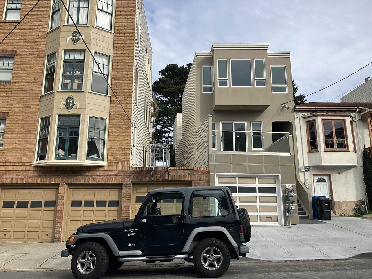
The apartments at 1211 14th Avenue and the flats at 1206-1208 15th Avenue (recently completed after a dozen halting years of construction) are angled on their north sides to respect the old hog farm’s property line.
Woody Beer and Coffee Fund
The Woody Beer and Coffee Fund supports Woody buying other people drinks.
You could be other people. Or you could donate to the fund. Or you can be both.
You can’t be Woody, which we can all agree would be strange.
Sources
“Notice of Land Grant No. 491,” San Francisco Examiner, March 22, 1870, pg. 5.
“Died,” San Francisco Call, November 16, 1894, pg. 8.
“Died,” San Francisco Call, May 12, 1895, pg. 14.
“Death Notices,” San Francisco Call, January 11, 1906, pg. 14.
“Funeral of Home Inmate Yesterday,” Oroville Daily Register, December 19, 1908, pg. 1.
(Plus U.S. Censuses and San Francisco Directories)